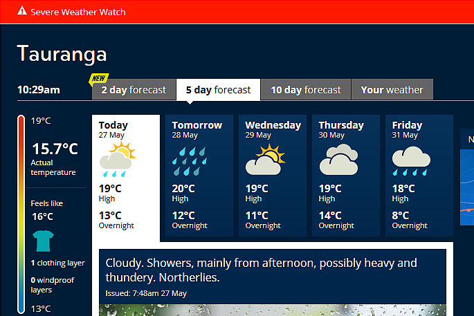
Heavy and thundery showers are being forecast for Tauranga today.
The MetService has issued a severe weather watch for the Bay of Plenty for heavy rain.
'Heavy rain is forecast for the west and north of the South Island and the Bay of Plenty.
'A period of strong winds is also expected for parts of the lower North Island.”
From Monday to early Friday, moist northwesterlies with a number of embedded fronts are forecast to affect the South Island, bringing periods of heavy rain to northern and western areas of the Island, says the weather organisation.
'A trough embedded in the northwest flow is expected to cross the North Island during Tuesday, bringing a period of heavy rain to the Bay of Plenty and strong or gale north to northwest wind to Taranaki, Wellington and Wairarapa.”
HEAVY RAIN WATCH
Area: Bay of Plenty east of Rotorua
Valid: 12 hours from 9am to 9pm Tuesday
Forecast: A period of heavy rain is expected during Tuesday.
Accumulations may approach warning criteria.
Area: Ranges of Westland north of Otira, Buller and Nelson
Valid: 16 hours from 9am Tuesday to 1am Wednesday
Forecast: A period of heavy rain is expected during Tuesday and into the early hours of Wednesday. Accumulations may approach warning criteria.
STRONG WIND WATCH
Area: Taranaki
Valid: 33 hours from 12pm Tuesday to 9pm Wednesday
Forecast: A period of strong or gale northerly winds is expected during Tuesday and may approach severe gale in exposed places.
Area: Wairarapa
Valid: 9 hours from 6pm Tuesday to 3am Wednesday
Forecast: A period of strong or gale northerly winds is expected during Tuesday and early Wednesday and may approach severe gale for a time in exposed places.
Area: Wellington
Valid: 12 hours from 3pm Tuesday to 3am Wednesday
Forecast: A period of strong or gale northerly winds is expected during Tuesday and early Wednesday and may approach severe gale for a time in exposed places.

0 comments
Leave a Comment
You must be logged in to make a comment.