A large low in the Tasman is slowly falling apart today but as it pushes into a large high to New Zealand's east it's making for occasionally blustery conditions around the upper North Island.
The winds have been described as being below gale force but some gusts are pushing closer to the gale mark out in marine areas for a time this morning. Peak winds should have also passed with north easterly winds slowly easing back across.
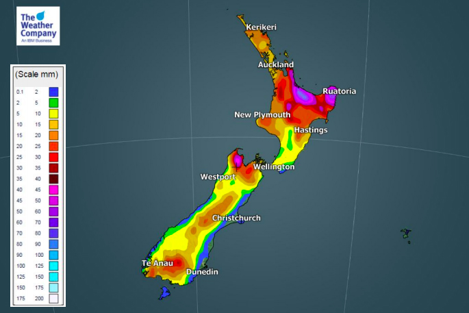
The rain band this morning moved through faster than expected with WeatherWatch.co.nz updating Auckland at 6am to say mainly dry.
The same patchy rain band is now clearing Waikato and soon western Bay of Plenty - in some cases this front is running quite a few hours earlier than expected, as is sometimes the case with these very large lows.
More cloud, showers and drizzle patches linger behind the front with the same windy north easterly for much of Saturday.
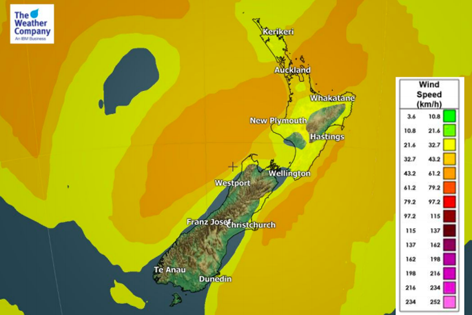
Wind speed.
Unlike the big low last weekend, the low this weekend is quickly falling apart and so too are some of the rain bands, making it a bit tricky to precisely track some of them.
By Sunday showers will be heavier but also more isolated in the upper North Island but there are thunderstorm risks on Sunday afternoon inland through both main islands.
Some of the downpours will again be particularly intense and slow moving around Southland and Otago and the Southern Alps - extreme care is needed in these conditions especially if the thunderstorms again turn 'severe'.
Sunday looks warmer than average for more parts of New Zealand too with less cloud cover expected than today.
- WeatherWatch.co.nz

0 comments
Leave a Comment
You must be logged in to make a comment.