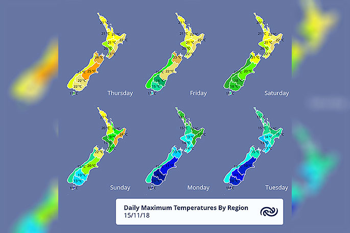
This weekend marks a turning point from the warm, settled weather that New Zealand has enjoyed for the last few days to a changeable, and even stormy regime.
This week has seen temperatures in the high twenties, and summer-like quantities of sunshine hours.
Next week, however, begins with cold southerlies and snow, potentially closing the higher passes.
The cause of the fine weather has been high pressure sitting over the country, but that has been put under increasing pressure by a front edging up from the south.
The front moves north over the western South Island on Saturday, then a cold southerly spreads up the east on Sunday, while the front makes ground over the North Island.
This will mean increasing cloud, with a spell of rain just about everywhere as the front moves up the country.
The good news for Christchurch is Friday's show day should stay dry until evening, with the worst of the weather waiting for Sunday's southerly.
This southerly will bring strong winds to the whole of the east coast, and snow as low as 600 metres to Southland and Canterbury on Sunday night.
'Spring still has a few tricks up its sleeve and windy, changeable conditions are a big part of that”, explains MetService meteorologist Tom Adams.
'Although not unusual for the season it certainly will feel like a change from this week. People may have become used to the settled conditions, but next week will not reward complacency so make sure you keep checking the forecast.
'Once this cool southerly comes through the South Island on Sunday and the North Island on Monday, it will be followed by a series of weather features making for a changeable week."

0 comments
Leave a Comment
You must be logged in to make a comment.