Daytime highs are again above average for today and tomorrow, some by over 10 degrees inland in the south as westerlies kick back in ahead of a slow moving cold front.
A large portion of the North Island will also be warmer than normal, although some coastal fringes will not be impacted so much, says WeatherWatch.co.nz.
Head forecaster Philip Duncan says daytime highs in the mid 20s are expected in both islands for a time over the next few days, but there will be a cool change coming.
"Parts of western and Central Otago, for example, will be in the low to mid 20s over the next day or two, but by Sunday the current forecast high for Queenstown is 12 degrees."
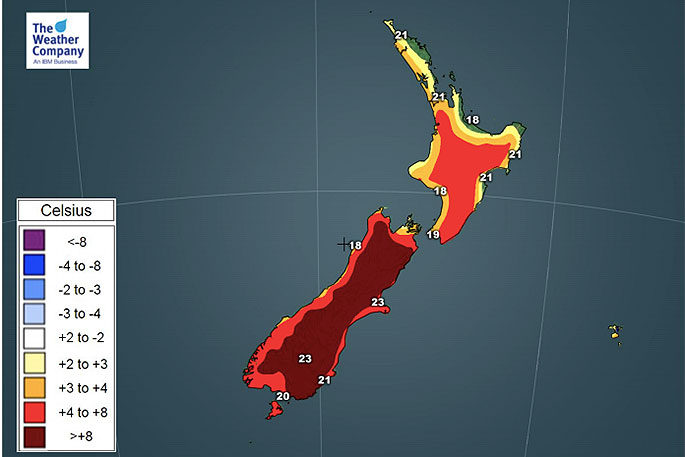
Temperature forecast for Thursday.
Phillip says Dunedin has 22 forecast for Thursday but down to 13 on Friday (and maybe only 10 or 11 next Monday).
On Thursday Christchurch has a high of around 24 degrees and by Sunday it is 13.
According to WeatherWatch.co.nz the North Island also may have some sort of cool down next week, especially in the east.
Napier is likely to hover in the low to mid 20s over the next few days but by next week may be struggling to climb above the low teens with even some rain in the forecast at this early stage (but a week away so can't yet lock in for sure).

0 comments
Leave a Comment
You must be logged in to make a comment.