A burst of rough weather is about to move into New Zealand this weekend and the country's mountains and ranges will create stronger winds, heavier rain for many, but also sunshine and warmth for others.
On Thursday a small areas of heavy downpours lies just off the Auckland and Waikato coastlines over the eastern Tasman Sea.
There is a chance a few thunderstorms will develop today amongst this cluster of downpours, most will be offshore.
"There is some chance we may get a thunderstorms over land in these areas," says WeatherWatch.co.nz
On Friday high pressure moves away from the country, slowly allowing a NW wind to develop in the South Island and this will help push temperatures up by several degrees above normal for some in the east and south.
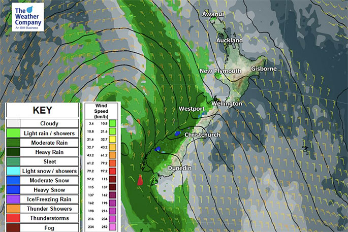
On Saturday, rain and snow are intensifying. Locally heavy downpours will move up the West Coast (watch for rain warnings) and and burst of snow is expected on the Southern Alps.
Strong NW winds (watch for potential wind warnings) will push into inland and eastern areas with gales possible in exposed areas.
These strong winds peak on Saturday as they move into the Cook Strait and lower North Island. Generally speaking, while strong, most places are below damaging threshold. Be prepared for isolated power cuts just in case.
Big waves will also be generated along the West Coast.
On Sunday the warmer than normal conditions across the country will start to drop.
By Monday and Tuesday of next week most places will be cooler, but 'back to normal' for late July.
WeatherWatch.co.nz says milder than average weather is still likely to return again mid to late next week.

0 comments
Leave a Comment
You must be logged in to make a comment.