This week gets off to a stormy start with heavy rain and thunderstorms for most parts of the North Island today.
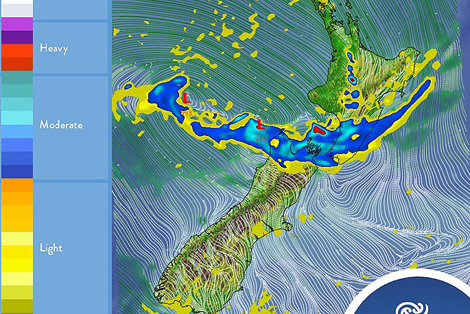
A complex low pressure system with several embedded fronts moves southeast across central New Zealand today bringing wet weather through to Wednesday.
'A severe weather warning for heavy rain is current for North Taranaki, with a broader heavy rain Watch for the western central North Island,” says MetService meteorologist Mark Bowe.
'There is a contrasting story over the South Island however, with a ridge of high pressure bringing mostly cloudy but settled conditions."
Moving into Tuesday a trough of low pressure lingers around the central North Island, moving north during the day and bringing showers with some possible heavy falls to western and northern areas.
The lower North Island can expect cooler temperatures with showers gradually easing during the evening.
Southerlies will gradually die out over the South Island with frosts possible in inland areas overnight.
Another low pressure system on Wednesday directs a strong easterly flow over the Auckland and Northland regions, with heavy showers possible especially in the north.
There is an improving trend for the South Island with the ridge continuing to build with just some scattered showers for the eastern parts of the Island.
As the low moves away to the northeast on Thursday, the weather improves with the southeasterlies easing for the rest of the country and remaining largely fine for the South Island. This improving trend continues into the weekend.
'Clearing skies will mean cool temperatures and morning frosts but better chances for Matariki viewers."

0 comments
Leave a Comment
You must be logged in to make a comment.