The weather office had warned us.
It was going to be an interesting weekend of storms. It started with a dark, grey, brooding Saturday afternoon of wind and rain.
Nothing to really unsettle us – they played rugby, league, hockey and netball as usual.
Life went on.
But 12 hours later, just after 4am today the main show started – it was loud as it was spectacular.
Half a dozen jarring and brilliant bursts of lightning which brought daylight to the even the best sealed bedrooms in the dead of night. And then the crashing of thunder that rattled windows.
It seemed right overhead with the thunder coming right off the back of the lightning.
The weather gods were waging war in our backyard. Then half an later it was over. The quiet was palpable.
But it wasn't just a harmless display of nature's forces because in Te Puke a house was damaged by a lightning strike.
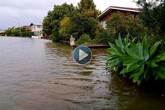
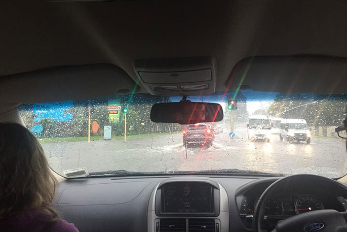
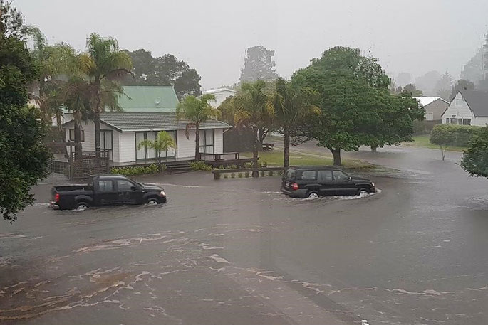
Dawn brought wind and rain squalls unlike anything the region has endured in recent times. Roads were flooded, trampolines got up to their tricks, trees were damaged.
Police say they had received three reports of flooding between midnight at 10.30am – Pyes Pa Rd, State Highway 33 and Mclean Rd.
'Our tramp ended up going over the fence it was tied to,” a Pyes Pa resident says.
'It's the first time it has moved in any of the recent storms so it must have been bad last night.”
Photos emerged of submerged roads in Whakatane. Riverside Dr, Kiwi St and Apanui Ave had become rivers of their own overnight, and a caller to the 0800 SunLive news hotline says The Strand in Whakatane has its own waterfall.
'There's a water fall at the back of The Strand that's like exploding into the road and has flooded out Canning Place.
'Some of the houses on Peace St are quite bad too.”
MetService is predicting a total rainfall forecast of 65mm today, while Te Puke has seen a maximum of 75mm/hr of rain.
NZTA says State Highway 25, Whangamata to Whiritoa, is closed in both directions due to flooding, and State Highway 25 Thames to Manaia has an area warning due to washout.
Waimana Gorge was flooded in both directions, as was State Highway 2 between Waihi and Athenree Gorge. Reports have also come in of flooding on the Matata Straights.
Police have asked that people avoid all unnecessary travel in and around Rotorua today, with severe flooding closing a number of roads in the CBD and surrounding suburbs.
The Cormandel experienced some heavy rain and strong winds overnight causing surface flooding across the district.
MetService has put a severe thunderstorm watch in place on the Coromandel Peninsula and Bay of Plenty bringing localised downpours of 25 to 40mm per hour and possibly more. Rainfall of this intensity can cause surface and/or flash flooding, slips and hazardous driving conditions.
It is advised against driving unless it's necessary, and to drive to the conditions.
Have you got any weather pictures? Seen any weather damage? Email them to [email protected]
 Surface flooding and rain in Rotorua. Photo: Paula McGee/Facebook.
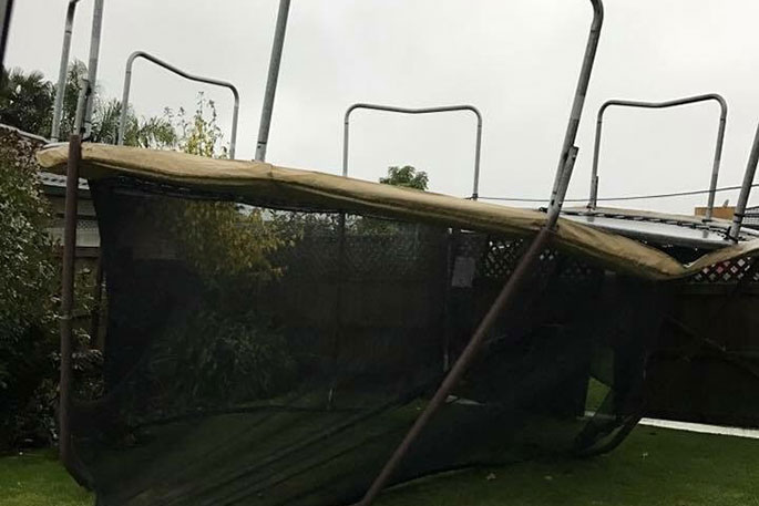 The wind rarked up this trampoline in Pyes Pa. Photo: Anita Saunders.
 Flooding in the Coromandel.
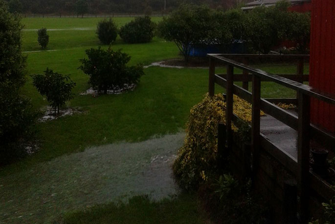
Flooding in Pyes Pa. Photo: Jennifer Sidwell/Facebook.
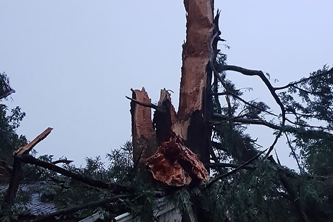 The effects of last night's lightning in Te Puke. Photo: Kris Johnston.
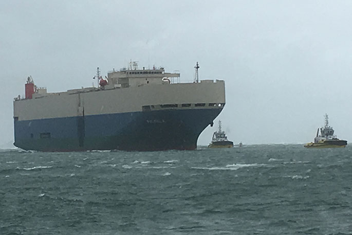
Port in a storm: the vehicle carrier Palmela enters Tauranga escorted by tugs Taitimu and Taipari.
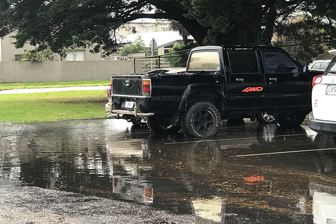
Flooding in Miro St, Mt Maunganui. Photo: Cameron Avery.

0 comments
Leave a Comment
You must be logged in to make a comment.