


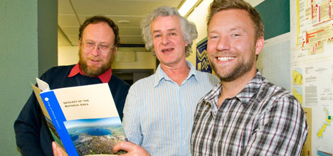
Seven years of fieldwork is paying off for scientists after the publication of a new geological map covering the wider Bay of Plenty.
Geologists have been working on a map of the wider Rotorua area, from Tauranga eastwards to Opotiki and southwards to the western Waikato and northern Hawke's Bay region.
From left: Professor Colin Wilson, Dr John Begg and Dr Graham Leonard with the new booklet and map.
GNS Science geologist Dr Graham Leonard says the project provides the first complete map and eruption history of all of New Zealand's huge caldera volcanoes.
'It looks at magma vents through lava and ash eruption deposits to the large lahar and sediment fans including the Hauraki and Rangitaiki plains and Tauranga basin.
'Geologists made several advances in geological knowledge during this mapping project.”
Graham says they discovered and dated previously unknown rock formations and tested theories about the timing and connections between eruptions and faulting.
Digital data from the map is already being used extensively in a number of scientific projects.

A new detailed geological map of the Bay of Plenty region covers New Zealand's super-volcanoes as well as the Waikato River, Rotorua, Taupo and Waikaremoana Lakes.
Users expected to benefit include the Department of Conservation, regional councils, geothermal energy companies, engineers, earth scientists and people with an interest in geology.
'It marks the end of one of the most comprehensive projects in the organisation's national mapping programme – called QMAP (quarter-million scale map).”
Graham says geologists spent hundreds of days in the field clambering over difficult terrain, tramping and travelling to hard-to-reach areas by four-wheel drive, helicopter, jet boat, and even on horseback.
'We've been mapping, sampling and recording information on rock types and other geological features.”
The map will replace existing geological maps of the area, published in the 1960s.
It combines information from hundreds of published and unpublished maps and scientific reports, including dozens of PhD thesis studies.
'A great deal of new research has also been added to produce a comprehensive compilation of this geologically diverse and tectonically active area.”
The map is a large full-colour 1:250,000-scale map and will be tucked into a sleeve in the back cover of a 102-page companion book.
Graham says it includes stunning colour photographs of volcanic and mountain landscapes, illustrations of the great variety of volcanic and sedimentary rocks, and numerous diagrams summarising aspects of the geology.

0 comments
Leave a Comment
You must be logged in to make a comment.