Heavy rain, high winds, thunderstorms and possible small tornadoes are all in the mix this afternoon.
This is the latest update from the MetService meteorologist Peter Little, who says it's going to get worse before it gets better.
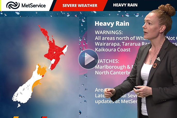
'It's not one of your better days. The heavier stuff has moved back in and unfortunately that is set to remain with you now for some time.”
Weather warnings for the Bay of Plenty and Coromandel will remain for some time to come.
'For Bay of Plenty and Rotorua it's basically going to continue until Thursday morning, 16 hours from 9am till 1am Thursday.
'Essentially the rest of today is looking very wet and there are thunderstorms to the north of you, so the weather is actually going to get worse before it gets better.
'The rain is definitely going to pick up. There are rumbles of thunder out to the north east of you and to the north at the moment and they are tracking southwards,” says Peter.
'It's possible you will get a thunderstorm this afternoon and you are in the area of our severe thunderstorm watch where there could be very heavy downpours of I believe, 25mm to 45mm an hour, it says in our thunderstorm outlook.
'There is a risk of severe storms. There could be damaging wind gusts of 110km/h or more and also a possibility of small tornadoes.
'There's definitely more to come, I'd be surprised if there are not some more problems in your district with surface flooding or other things.”
Offshore there is a gale warning with wind speeds this afternoon of 25knots gusting to 35knots, (64km/h) gusting to 50 knots (92km/h) for a time later this afternoon.
Tomorrow the wind is expected to drop and the downpour reduce to showers.
Waikato civil defence teams co-operating closely over rainfall response
The Waikato Civil Defence Group headquarters in Hamilton and council civil defence teams around the region are co-operating closely on managing the response to rainfall-related flooding and community welfare issues.
The latest conference call involving council and emergency service representatives this afternoon heard of a range of roading and flooding-related issues being handled by various councils and services.
All regional civil defence emergency operating centres have either formally activated or are actively monitoring developments around the region. Those developments include:
- 150 schoolchildren unable to leave a school camp in Port Waikato for now until roads are clear
- residents of Waharau on the Firth of Thames being advised to self-evacuate if they don't want to be cut off by a slip and problems with a bridge
- numerous slips around the region.
'We are watching river levels and the potential for more high winds and heavy rain closely,” said group controller Lee Hazlewood.
This afternoon's conference call allowed for more detailed information sharing on what's happening and weather predictions, and the identification of potential issues and opportunities for mutual support.
'The range of matters being handled by group members is extensive but at this stage we collectively have things well in hand. However, we are monitoring closely what's happening and what may happen.
'We are being well supported by the regional council's hazards team, council emergency responders and emergency services.
'While the outlook is for the weather to ease by tomorrow, there is still a risk of significant downpours this afternoon and this evening, particularly on the Coromandel.
'So civil defence teams will remain on alert to provide necessary support to communities as required until this weather event is over.”
- You can keep up to date with the latest information by visiting our Facebook page, www.facebook.com/WaikatoCivilDefence or checking out our website at www.waikatoregioncdemg.govt.nz.
- Follow us on Twitter @civildefencewkt

0 comments
Leave a Comment
You must be logged in to make a comment.