Further warnings are being issued as the remnants of Cyclone Debbie are felt throughout the North Island.
The MetService has upgraded the severe weather watch to a severe weather warning for for a majority of areas including Auckland, Coromandel, Bay of Plenty, the central plateau and Taranaki.
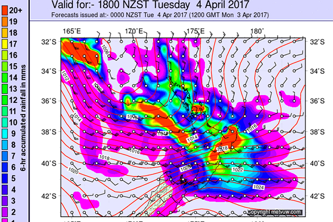
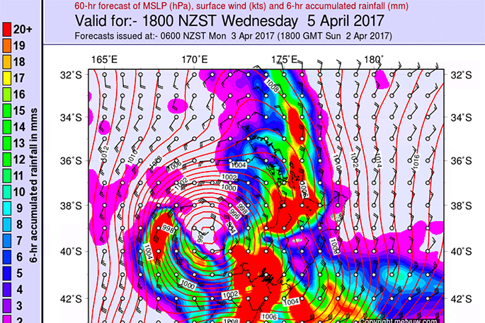
The low is expected to go across central New Zealand early Thursday, with rain already falling in some areas.
Rain is forecast to become heavy this afternoon for the Coromandel Peninsula and expected to continue until midnight Wednesday.
"We don't expect the severe intensity we had in the recent early March weather event, however it is still significant and we need to be aware it could be unpleasant and take precautions," advises Thames Coromandel District Council Civil Defence Controller, Garry Towler.
"Please manage your travel arrangements and take extra care on our roads. There are dozens of slips still unstable from the previous weather event and these may continue to slip leaving debris on our state highways and local roads.”
In the 33 hours from 3pm today until midnight Wednesday, 200 to 300mm may accumulate on the ranges, with lesser amounts 100 to 150mm possible elsewhere. Peak intensities of 25 to 45mm per hour and thunderstorms possible.
MetService will issue the next severe weather warning at or before 9pm Tuesday, see here.
The expected down pour coincides with high tides today at approximately 1pm and tomorrow at 1.30am and 2pm across the Coromandel Peninsula.
"Our ground saturation levels are very high which means our water table is elevated, therefore isolated flooding is highly likely," says Garry
This is a significant amount of rain and people are advised to also watch out for rapidly rising rivers and streams and flooding.

0 comments
Leave a Comment
You must be logged in to make a comment.