


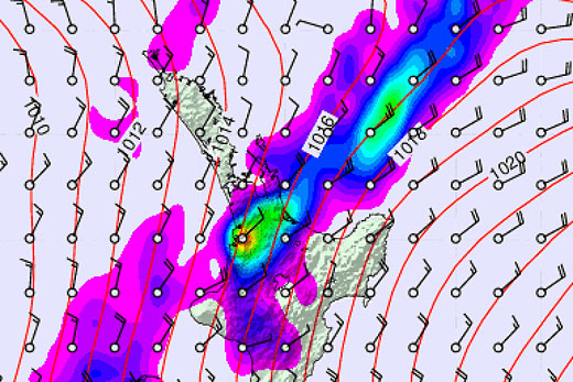
The weather for the long weekend is about to pack up with Metservice warning of bursts of heavy rain for Northland Auckland and the Coromandel today and early tomorrow.
Two troughs embedded in a moist northeasterly flow, one over Northland and a second over northern Auckland, are expected to drift slowly southwards bringing bursts of heavy localised rain to parts of Northland, Auckland and Coromandel Peninsula.
Metvuw's take on the local weather at noon Monday. Plotted by James McGregor.
The weather watch is for the possibility that rainfall accumulations could become warning amounts for Auckland and the Coromandel, especially in northern and eastern areas and about Great Barrier Island:
Periods of rain during today and Monday morning are likely to be heavy at times, with a potential for it to reach short duration thresholds in some areas of 50mm in a 6 hour period. Additionally there is a potential for intense hourly rain rates of 25 to 35mm per hour occurring in localised places. Rainfall of this nature if it occurs, has the potential to cause surface flooding, especially about urban areas.
There is still quite some uncertainty between the computer models on exactly where the heaviest rain will be, and people are advised to keep up to date with the latest forecasts in case further areas are added to this Watch or are upgraded to a full Warning.
The weather watch will be reviewed by 9pm Sunday 31 May 2015.

1 comment
weather
Posted on 31-05-2015 16:00 | By rosscoo
All good things must come to an end. It was good while it lasted.
Leave a Comment
You must be logged in to make a comment.