Biting southerly gales and low snow levels are expected to hit New Zealand this week as a powerful mix of weather systems come together to develop a winter storm.
Civil Defence is urging people across the country, particularly those in the South Island and central North Island, to prepare for power and phone cuts in the worst storm of the winter so far.
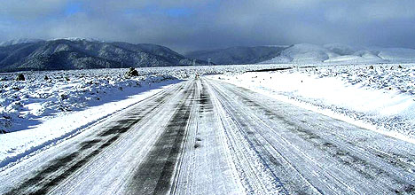
Snow is expected to fall on the Desert Road today or tomorrow.
The MetService is warning people temperatures could drop to four degrees in Tauranga during the night time and remain around 11 degrees in the day with the cold snap hanging around until next weekend.
'This winter storm will have quite a bit of bark and bite, and is expected to bring widespread severe weather for much of New Zealand,” says media and communication meteorologist Dan Corbett.
He says the strong southerly change will begin to work up the South Island this morning and will reach the far North by tomorrow.
'Another deepening low to the east of central New Zealand will generate south or southwesterly winds up to severe gale around many exposed coasts.
'This bitterly cold southerly flow will result in snow showers, which could fall to low levels as far north as central New Zealand. There could also be some significant snow accumulation in parts of Canterbury, including Christchurch, and in Marlborough where up to 80cm is possible for this event.”
Strong westerlies from Northland to Taranaki, accompanied by squally showers, may give high wind gusts throughout Thursday, with large waves also expected on many beaches.
'This very intense and significant winter storm will slowly ease by the weekend, leaving cold frosty nights in its wake.”

0 comments
Leave a Comment
You must be logged in to make a comment.