
A series of fronts are expected to make their way over the country this week, bringing strong northwesterly winds and periods of rain.
On Thursday, a cold southwesterly flow takes over, and while it brings some clearer skies over the South Island, it also leads to lower temperatures.
"As the cold front moves northwards early tomorrow morning, northwesterly winds strengthen over the lower North Island," says MetService Meteorologist Juliane Bergdolt.
"Winds may approach severe gale at times within the Watch area, particularly about the hills, before weakening rapidly and moving eastwards off the country Tuesday night."
Overnight from Tuesday into Wednesday a low-pressure system passes just to the south of the South Island, bringing another cold front onto the lower South Island.
"We see a repeating pattern on Wednesday as another front moves northwards up the country, reaching Christchurch around midday.
"Much like Monday’s front, it is preceded by strengthening northwesterlies and potentially heavy rain. Severe Weather Watches may be issued for similar regions as earlier in the week in the coming days.
"However, this front is followed by strong and cold southwesterly winds, bringing a distinct dip in the temperatures just ahead of the long weekend."
Looking ahead the Easter forecast still has some uncertainties, with a low-pressure system to the northeast of the North Island that may have a part to play.
However, the driest weather will be in the South Island, with Central Otago, inland Canterbury, and the West Coast most likely to see the sun.
However, there will be a chill in the air so wrap up warm for any early morning Easter egg hunts.
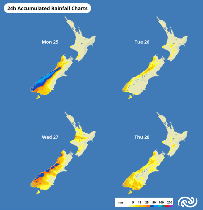 Image: MetService.

0 comments
Leave a Comment
You must be logged in to make a comment.