
After a dry February so far, the last week of meteorological summer starts off wet for the North Island, with settled weather for the South Island.
Heavy rain watches have been lifted for Great Barrier Island, the Coromandel Peninsula and the Bay of Plenty on Monday, but MetService is forecasting the rain in the second half of the week to mostly fall in dry eastern areas.
The Bay of Plenty, Great Barrier Island, and the Coromandel Peninsula were all under heavy rain watches until the early hours of Tuesday, as warm humid air over these areas brings an increased risk of localised downpours.
“The risk of localised downpours was the biggest concern with these heavy rain watches, as peak intensities of 20 to 35 mm per hour could occur,” says MetService Meteorologist Clare O’Connor.
“Downpours such as these can cause surface flooding and hazardous driving conditions so if you are in an area covered by a heavy rain watch make sure you keep an eye on the MetService rain radar and forecast throughout the day.”
This humid air is wrapped into an area of low pressure which crosses the North Island in the early hours of Tuesday morning, says Clare.
“As the low moves to the east of New Zealand, it takes the rain with it, feeding showers onshore on the east coasts of both main islands.
“As these eastern areas have been the drier locations of this summer, any rainfall is likely welcome, however, accumulations expected will not alleviate the dry conditions.
“After a month of see-sawing temperatures, this week these return to normal for the time of year, although fresh southerly winds on Wednesday afternoon about the lower North Island will add a brief chill to the air.”
For the extra day of February 29, it is looking relatively settled across the country.
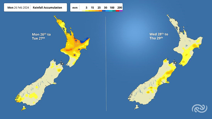 Image: MetService.

0 comments
Leave a Comment
You must be logged in to make a comment.