
You can deny it all you like, but there are hints that Autumn's weather pattern is turning up on NZ's back door step.
WeatherWatch says Southern Ocean cold fronts are swiping the very south of the country - bringing a traditional El Nino pattern across the South Island with rain on the West Coast, and most of that in the lower half.
"Temperature-wise the result of these cold fronts is a more Autumn like pattern for southern regions, most noticeable today with daytime highs down around 10 degrees on where they were yesterday," says a spokesperson for the weather organisation.
"But, because we are still in summer, these colder snaps tend to only last a day or so. Tomorrow temperatures bounce back by around 5 degrees (or more) on today.
"If you're in the North Island you won't notice this cold front - other than getting a bit windy off and on in Wellington and coastal Cook Strait areas. Further north and east the hot weather continues thanks to high pressure... with daytime highs in the upper 20s and even lower 30s."
WeatherWatch.co.nz is expecting very little rain for many regions for the next 10 days to two weeks.
"Most of it will fall on the southern West Coast."
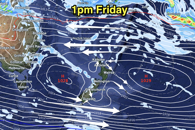
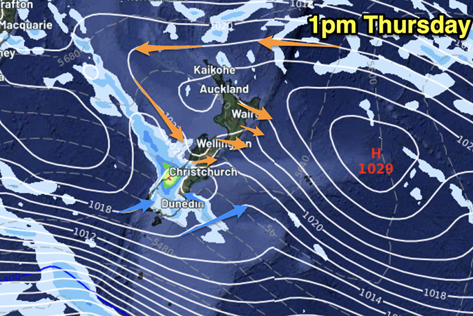 The weather map for 1pm today, above, versus, the weather map for 1pm tomorrow.

0 comments
Leave a Comment
You must be logged in to make a comment.