
This week marks the anniversary of Cyclone Gabrielle and MetService would like to take a moment to acknowledge the resilience and strength of those communities still in recovery from Gabrielle’s devasting impacts.
The forecast weather this week is a stark contrast to what was experienced a year ago.
After a chilly Monday morning, a ridge of high pressure continues to hold firm over Aotearoa New Zealand, bringing settled weather.
There is, however, brief mid-week rain and strong winds for those in the western and lower South Island.
The cool temperatures this morning were some of the lowest experienced so far this year in parts of the North Island.
MetService meteorologist Mmathapelo Makgabutlane details: “Taupō and Palmerston North were both at 2.8°C, while Masterton was a crisp 3.3°C.
“Thankfully, this is not a sign that summer is over, as temperatures are poised to bounce back as the week goes on.
“By Wednesday, the eastern South Island can expect warm daytime temperatures in the upper twenties, possibly even 30°C, and similarly for the eastern North Island on Thursday.”
With the outdoor events season still in full swing, settled weather will be welcome news to those wishing to take full advantage.
“There will only be a minor risk of a shower for those heading out to watch the Black Caps take on South Africa in Hamilton this week.
“In the eastern North Island, the weather is looking warm and sunny for the Art Deco Festival kicking off in Napier on Thursday.
“Amidst the allure of all the sunshine, however, it’s important to stay sun smart,” Mmathapelo says.
The settled weather will be interrupted midweek by a brief front that is expected for the western and lower South Island on Wednesday and Thursday, bringing bouts of wet weather.
It also moves through with strong winds.
“Some of that rain could be heavier for places like Fiordland, Westland, and western Southland, while winds in Fiordland, Southland and Otago may approach severe gale.
“Be sure to keep an eye out for any Watches or Warnings covering these or other areas in the coming days,” Mmathapelo advises.
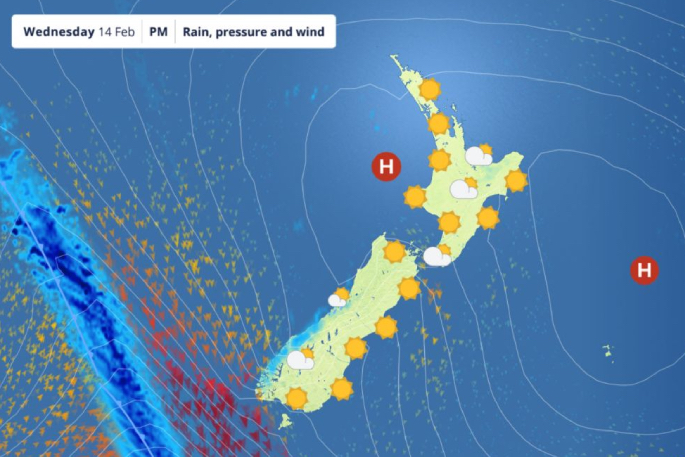 Photo supplied/ MetService.

0 comments
Leave a Comment
You must be logged in to make a comment.