.jpg)
Warnings to prepare as much as possible for Cyclone Gabrielle were proved well-founded overnight as strong gusts struck the Far North and Coromandel residents were told to prepare to evacuate earlier than anticipated.
Late on Saturday, MetService meteorologist John Law said the northern parts of the country would be the first to experience high winds, with gusts of up to 120-130kn per hour from 7am in Northland and Auckland, with exposed areas such as Whangaparoa and Great Barrier Island likely to get hit the worst.
Those winds could last right through until Tuesday, he says.
North Islanders spent Saturday racing to prepare for the worst case scenario with supermarket shelves stripped and sandbags running dry at collection points in Auckland.
While MetService downgraded Cyclone Gabrielle to a category 2 cyclone on Saturday, it was tracking closer than previous projections suggested. Earlier forecasts of the cyclone making landfall on Sunday were revised as gusts hit 100kph at Cape Reinga on Saturday night.
A category 2 cyclone's wind speeds typically sit around 89-118kph, while a category 3 sits around 119kph-157kph.
Air New Zealand began cancelling some flights on Saturday night, and there were warnings Auckland's Harbour Bridge could close.
Motorists were warned to avoid non-essential travel amid warnings of a 'widespread and significant weather event”.
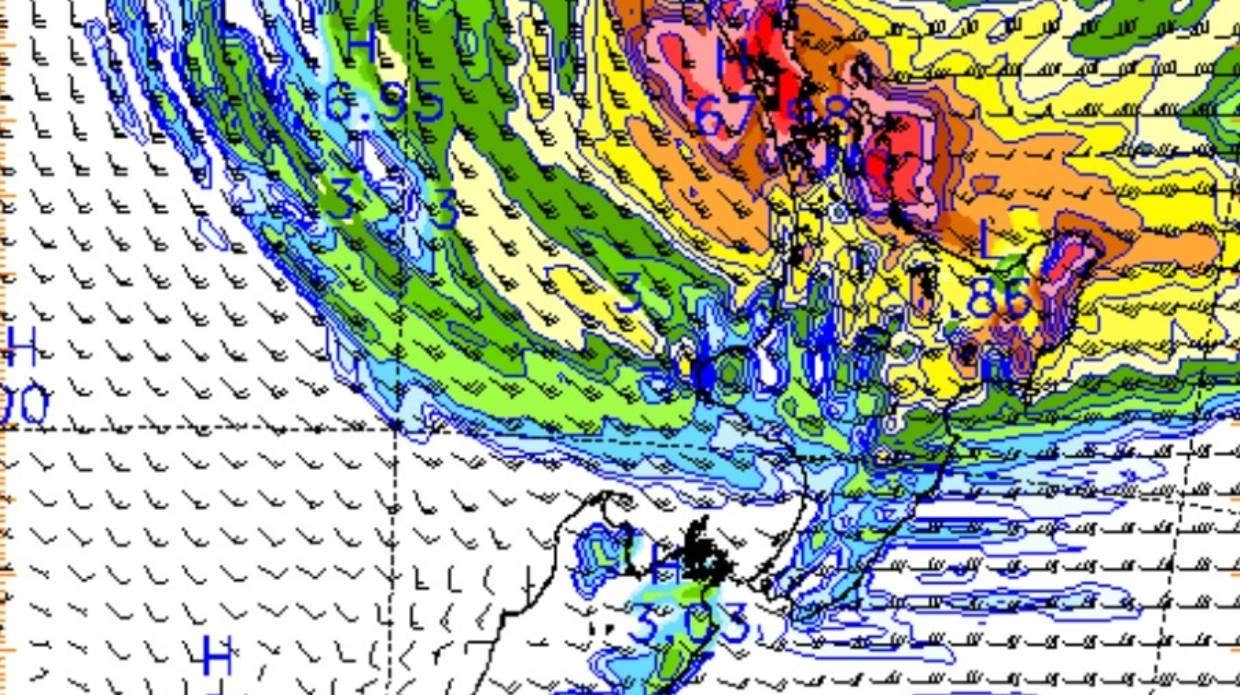
MetService's rain forecast shows heavy downpours from Cyclone Gabrielle. Image: MetService.
And in Coromandel, expected to take the brunt of the storm along with Gisborne, roading contractors were spread across the district to ensure they wouldn't be caught out by slips or road closures. Residents of the Thames and Coromandel districts were on Saturday night being asked to leave voluntarily, recalling 1988's devastating Cyclone Bola.
Garry Towler, civil defence controller for the region, said with the storm approaching faster than previously thought, emergency services had to push forward safety plans. He said heavy rain and winds were expected to lash the region on Sunday afternoon, instead of Monday, as first thought.
Towler said they know the cyclone would be destructive and possibly on a scale similar to Bola. 'It's going to have a severe impact, so please take this seriously and make sure you are somewhere safe by Sunday night,” he said.
Earlier in the day the district mayor admitted, 'This one has us worried – the amount of rainfall. We know we're going to get slips.”
The tropical cyclone is an incoming blow for regions still picking up the pieces and counting the costs of the January 27 floods.
MetService has warned Northland and Auckland could expect between 200-300mm of rain from early Sunday till mid-Tuesday, while the Coromandel Peninsula, Gisborne and Hawke's Bay could reach up to 400mm.
And although those areas are set to be the hardest hit, most of the island should expect severe weather. Average wind speeds could pick up to around 90 kph, with gusts of around 130-140 kph.
But as some braced for the incoming cyclone, teams of volunteers in Auckland's Mangere spent Saturday trying to clean up the mess left in the wake of last month's floods.
Community leader Dave Letele said residents were fed up with bureaucracy around official cleanup plans, so it was locals that were getting on with it, lugging sodden carpets, mattresses and ruined whiteware out to curbs for collection.
Although residents were well-prepared for the cyclone, many people who'd lost so much already were fearing further destruction.
'Some of the families are staying in houses that have been red or orange stickered. A lot of people are too shy to ask for help or think there are people worse off than them.”
As North Islanders were being urged to clear gutters and drains, and prepare three days worth of food, water and supplies, at the Civil Defence centre in Mangere nearly 10,000 food parcels had been supplied to people in need.
Manurewa resident Ezekiel and his wife and young children were at the centre as they were already 'living on the edge”.
'We only just get by with what we get, so we can't go spending extra on things we usually wouldn't.”
In Auckland, more than 60,0000 sandbags were made available but demand still outstripped supply. A North Shore resident said Windsor Park's station was chaos at midday and so crowded there was hardly any room to get around.
'People were taking 20, 30, 40 bags at a time. When we got there, there were no bags left,” she said.
Just as people flocked to sandbagging stations, others swarmed Auckland supermarkets with Greenlane's Countdown adopting a one-in-one-out policy like those experienced in lockdown.
The national chain later implored people to only buy what they need, assuring customers it had plenty of stock and was sending hundreds of extra supplies to its stores.
'Today alone there will be over 100,000 bottles water arriving in our North Island supermarkets.”
At a Whangamatā sandbagging station, local man Phil Keogh said the town was on edge – both over safety and the financial impact – but people were looking out for each other.
'We're all worried ... there are a lot of locals out there asking if they can do stuff for their neighbours ... People are pitching in.”
His family had filled extra bags for those who needed them and locals were making sure elderly neighbours had some too.
In Northland, civil defence was urging locals to heed warnings and prepare by attaching waterproof plastic around exterior doors and tying things down. Civil defence and evacuation centres were being put on standby.
Northland Civil Defence Controller Graeme MacDonald said with the forecast heavy rain coming on top of recent heavy rain, streams and rivers may rise rapidly and cause disruption in flood-prone areas.
'Surface flooding, slips and flood water are likely to close roads and disrupt travel with flooding in low-lying areas possible.”
On Norfolk Island, residents were also bracing for what's predicted to be the most destructive weather to hit in three decades
Norfolk Island administrator Eric Hutchinson said residents were expecting power outages, fallen trees and the potential for houses to lose roofs.
Tourists had been urged to leave ahead of the storm, but anywhere between 800 and 950 visitors likely remained on the island. Teams of military and emergency personnel were on standby.

0 comments
Leave a Comment
You must be logged in to make a comment.