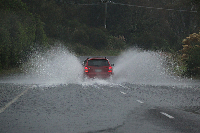
With the wild weather hitting the North Island today, MetService is providing an update on the latest heavy rain warnings across the Bay of Plenty and Coromandel.
A MetService spokesperson says showers are 'expected through the rest of the weekend” even once the rain begins to ease.
The Bay of Plenty west of Whakatāne has a rain warning from 10am Friday, January 27 to 7pm Saturday, January 28.
'Expect 130 to 180 mm of rain about the ranges, and 70 to 110 mm elsewhere. Peak rates of 15 to 25 mm/h from this evening, especially about the ranges, however, rates of 25 to 35 mm/h are possible in thunderstorms.”
The Coromandel Peninsula has a rain warning from 9am Friday, January 27 to 12pm Saturday, January 28.
'Expect 120 to 160 mm of rain about the ranges, and 70 to 100 mm near the coast. Peak rates of 15 to 25 mm/h, especially about the ranges, however, rates of 25 to 35 mm/h are possible in thunderstorms.”
This comes as a major Coromandel highway was closed earlier today due to instability caused by the wet weather.
'A sub-tropical low lies slow-moving to the northwest of New Zealand, and directs a strong and humid northeast flow across the North Island. Heavy rain is likely in a number of regions today and/or Saturday, along with strong to gale northeasterly winds.
'People are advised to keep up to date with forecasts in case any changes are made, or further areas are added.”
Below are the full list of heavy rain warnings across the country
Area: Northland
Valid: 8 hours from 9:00am Fri 27 Jan to 5:00pm Fri 27 Jan
Forecast: Expect 50 to 70 mm of rain, especially in the east and north, with thunderstorms possible. This amount is in addition to the rain that has already fallen. Peak rates of 15 to 25 mm/h, however, rates of 25 to 40 mm/h are possible in localised downpours.
Note, scattered heavy showers are forecast to follow the broadscale heavy rain.
Area: Auckland
Valid: 13 hours from 9:00am Fri 27 Jan to 10:00pm Fri 27 Jan
Forecast: Expect 50 to 80 mm of rain, especially in the east and north, with thunderstorms possible. This amount is in addition to the rain that has already fallen. Peak rates of 15 to 25 mm/h, however, rates of 25 to 40 mm/h are possible in localised downpours.
Area: Coromandel Peninsula
Valid: 27 hours from 9:00am Fri 27 Jan to 12:00pm Sat 28 Jan
Forecast: Expect 120 to 160 mm of rain about the ranges, and 70 to 100 mm near the coast. Peak rates of 15 to 25 mm/h, especially about the ranges, however, rates of 25 to 35 mm/h are possible in thunderstorms.
"Note, once the heavy rain eases, showers are expected through the rest of the weekend."
Area: Bay of Plenty west of Whakatane
Valid: 33 hours from 10:00am Fri 27 Jan to 7:00pm Sat 28 Jan
Forecast: Expect 130 to 180 mm of rain about the ranges, and 70 to 110 mm elsewhere. Peak rates of 15 to 25 mm/h from this evening, especially about the ranges, however, rates of 25 to 35 mm/h are possible in thunderstorms.
Area: Mount Taranaki
Valid: 21 hours from 1:00pm Fri 27 Jan to 10:00am Sat 28 Jan
Forecast: Expect 180 to 230 mm of rain. Peak rates of 15 to 25 mm/h.
To view the latest Tauranga forecast, visit the MetService website.

0 comments
Leave a Comment
You must be logged in to make a comment.