Another storm is lining up to slam into the North Island early next week, ensuring 'summer is not returning anytime soon”.
While heavy rain is set to batter the North Island on Thursday, with the Coromandel set to be the worst hit area with a heavy rain warning in place, don't expect any relief next week.
'Summer is not going to return anytime soon” says MetService meteorologist Jessie Owen.
'It definitely looks like we're not out of the woods.”
Owen says a subtropical low would bring more heavy rain to the North Island next week – but it was a bit too early to say exactly where the worst would hit.
'[Subtropical lows are] not as well-defined as the nice fronts we see, they're very changeable,” she says.
Early forecasts for Tuesday show it could hit the north-east coast next Tuesday, and potential bring gale force winds, heavy rain and storm swells.
The East Coast could also be in the firing line.
Owen expected the low would bring lots of moisture and, by the end of the weekend, they would be in a better position to forecast where exactly could expect to see the worst of the weather.
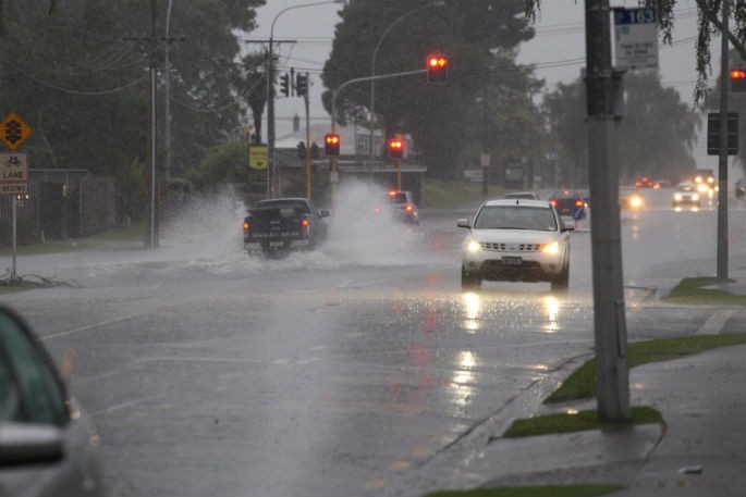
Meanwhile, while warnings have been issued across the Coromandel for people to either head home or be prepared to take shelter, it's been wet. In Auckland, MetService recorded 12.6mm of rain by 7:30am, forecasting a total of 62mm throughout Thursday.
MetService has also issued a heavy rain warning for the Bay of Plenty west of Whakatāne and north of Rotorua until midnight on Friday, January 6.
MetService also warned heavy rains 'may cause streams and rivers to rise rapidly”.
'Surface flooding and slips are also possible and driving conditions may be hazardous.”
Heavy rain warnings were also in effect in the South Island, for Tasman northwest of Motueka until 11am Friday and the ranges of Westland south of Otira until 4am Friday.
MetService forecaster Aidan Pyselman says almost nowhere would escape the bad weather this week.
The culprit was a low – a region of air that spirals inwards, bringing wet and windy weather – sitting in the north of the Tasman Sea.
It couldn't progress and move away from New Zealand because a high pressure system east of the Chatham Islands had 'kind of just parked” there, blocking the low from moving.

1 comment
Depressing!!
Posted on 06-01-2023 09:00 | By The Professor
I'm guessing things will come right with the weather sometime soon after everyone is back to work.
Leave a Comment
You must be logged in to make a comment.