Another day or two of active weather is on the cards for New Zealand.
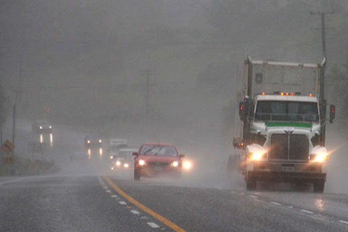
The MetService is highlighting a risk of thunderstorms for most of the country today.
A heavy rain watch has also been issued for the Tararua Ranges, running until 3am on Friday.
"Aotearoa is currently lying under an unsettled westerly flow, with a series of active fronts bringing showers, some heavy with possible thunderstorms and hail," says MetService meteorologist Alwyn Bakker.
"All of the North Island sees some risk of thunderstorms on Thursday, as well as northern Westland and Buller, the Canterbury Plains, Otago, and Southland.
"In the North Island, those thunderstorms may be squally, with wind gusts of 80-100km/h possible."
With a move away from the recent northwesterlies, temperatures are expected to return to more normal levels for this time of year.
"Winds from the northwest tend to drag more tropical air towards Aotearoa, which is warmer and more humid.
"These conditions are generally more unstable, leading to an increased risk of thunderstorms. As the flow loses its northerly component, we lose that access to tropical air, temperatures decrease, and the risk of thunderstorms tends to follow suit."
The westerly flow is set to ease on Friday, before a broad trough moves eastward across the country over the weekend, bringing more showers for most.
"At this stage, different computer projections disagree about the speed of this next weather feature, so keep up to date with the latest forecasts at metservice.com,"
The weather around the country looks generally settled on Monday but another band of rain is lined up to cross from the west before month's end.
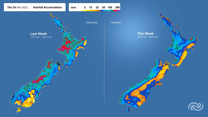 Image: MetService.

0 comments
Leave a Comment
You must be logged in to make a comment.