


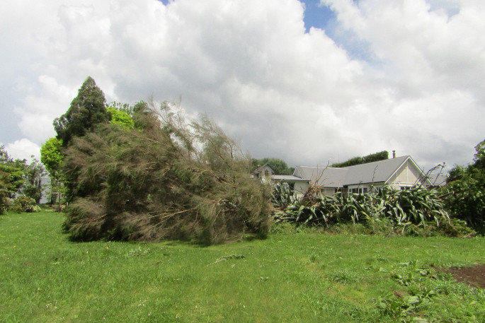
An active band of thunderstorms is expected to move eastwards across the North Island this afternoon and evening.
The MetService has issued a thunderstorm watch for several regions, including the Bay of Plenty and Coromandel areas.
'Some of these thunderstorms may be severe, producing damaging wind gusts in excess of 110 km/h and a few small tornadoes,” warns a MetService spokesperson.
'In addition, for regions from Waikato and Bay of Plenty southwards, localised downpours of 25 to 40mm/hr are possible.
'These squally winds and possible small tornadoes may cause some structural damage, including damage to trees and power lines, and make driving hazardous.
'If any tornadoes occur, they will only affect very localised areas.
'Rainfall of this intensity can cause surface and/or flash flooding, especially about low-lying areas such as streams, rivers or narrow valleys, and may also lead to slips.”
Severe weather is forecast to impact the region today, tomorrow and Thursday morning.
The MetService says an unstable northwest flow with embedded fronts is expected to deliver periods of heavy rain and thunderstorms to many areas, especially in the north and west, along with northwest gales in some places.
'Warnings and watches for heavy rain and severe north to northwest gales are in force.
'Please keep up to date with the latest forecasts in case any watches are upgraded to warnings, changes are made or more areas are added.”
Heavy Rain Warning - Orange
Heavy rain may cause streams and rivers to rise rapidly. Surface flooding and slips are also possible and driving conditions may be hazardous.
Area: Bay of Plenty east of Whakatane, also Gisborne north of Ruatoria and inland areas farther south
Valid: 17 hours from 2pm Tue 22 Nov to 7am Wed 23 Nov
Forecast: Expect 100 to 140mm of rain to accumulate. Peak rates of 15 to 25mm/h, but up to 40 mm/h in possible downpours, and thunderstorms in Bay of Plenty. Note that a watch for severe thunderstorms with downpours bringing rainfall intensities of 25 to 40 mm/h has been issued for the Bay of Plenty.
Area: The ranges of Westland south of Otira
Valid: 9 hours from 9am Tue 22 Nov to 6pm Tue 22 Nov
Forecast: In addition to the 40 to 80 mm of rain which has accumulated in the last 24 hours expect another 60 to 80 mm. Peak rates of 15 to 25 mm/h, and thunderstorms likely. Note that further bursts of heavy rain are likely to affect this area from Wednesday afternoon and into Thursday morning.
Heavy Rain Watch
Area: Northland, especially in the north and east
Valid: 17 hours from 9am Tue 22 Nov to 2am Wed 23 Nov
Forecast: Periods of heavy rain and thunderstorms, with downpours possible. Rainfall amounts may approach warning criteria.
Area: The central North Island high country, also Waitomo and North Taranaki including the Mountain
Valid: 12 hours from 4pm Tue 22 Nov to 4am Wed 23 Nov
Forecast: Periods of heavy rain and thunderstorms, with downpours possible. Rainfall amounts may approach warning criteria. Note that a watch for severe thunderstorms with downpours bringing rainfall intensities of 25 to 40 mm/h has been issued.
Area: Buller
Valid: 19 hours from 1pm Tue 22 Nov to 8am Wed 23 Nov
Forecast: Periods of heavy rain and possible thunderstorms. Rainfall amounts may approach warning criteria, especially about the ranges south of Karamea.
Area: Fiordland north of Doubtful Sound
Valid: 41 hours from 9am Tue 22 Nov to 2am Thu 24 Nov
Forecast: Periods of heavy rain and possible thunderstorms. Note that the rain is likely to ease for a time Tuesday evening and Wednesday morning. Rainfall amounts may approach warning criteria.
Strong Wind Watch
Area: Northland
Valid: 11 hours from 3pm Tue 22 Nov to 2am Wed 23 Nov
Forecast: Northerly winds may approach severe gale in exposed places.
Area: Auckland, Great Barrier Island and Coromandel Peninsula
Valid: 13 hours from 5pm Tue 22 Nov to 6am Wed 23 Nov
Forecast: Northerly winds changing westerly around midnight. Winds may approach severe gale in exposed places.
Area: Bay of Plenty and Gisborne
Valid: 14 hours from 5pm Tue 22 Nov to 7am Wed 23 Nov
Forecast: North to northwest winds may approach severe gale in exposed places. Note that the strongest winds are likely to affect the ranges of Gisborne and the eastern ranges of Bay of Plenty.
Area: Hawke's Bay south of Waipukurau, Wairarapa including the Tararua District and Wellington.
Valid: 17 hours from 1pm Wed 23 Nov to 6am Thu 24 Nov
Forecast: Northwest winds may approach severe gale at times.
Area: Canterbury High Country
Valid: 5 hours from 9am Tue 22 Nov to 2pm Tue 22 Nov
Forecast: Northwest winds may approach severe gale in exposed places.

0 comments
Leave a Comment
You must be logged in to make a comment.