MetService is forecasting a ridge of high pressure will bring settled weather for most of New Zealand this week.
However, a low pressure system approaching from the north briefly shoulders its way in on Tuesday, bringing rain to the upper North Island before sliding away to the east on Wednesday.
Benign weather returns as the ridge re-establishes, but as it tracks eastwards on Thursday and Friday, it opens the door for a front to approach the country from the north.
The front sweeps over New Zealand from Friday, delivering a burst of potentially severe wind and rain for some this weekend.
High pressure is usually associated with clear skies and dry weather, but if a system hangs around for too long that can change.
"Moisture evaporating from the ground and bodies of water can get trapped under a high if there's no change of airmass, forming clouds and even triggering showers," says MetService meteorologist Alwyn Bakker.
"However, with temperatures forecast to be around average for this time of year, the showers that do pop up aren't likely to be spectacular."
With conditions set to be broadly dry, it would be wise to be careful when setting off any fireworks left over from Guy Fawkes celebrations.
"'Keep a bucket of water on hand to drop any spent fireworks into, as they can still be hot enough to start fires in dry grass after use."
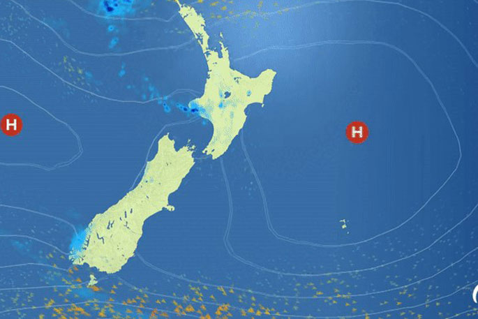
Image: MetService.

0 comments
Leave a Comment
You must be logged in to make a comment.