MetService has issued a severe weather warning for New Zealand.
The Bay of Plenty area around Opotiki is expected to receive heavy rain from Sunday afternoon through to Monday afternoon.
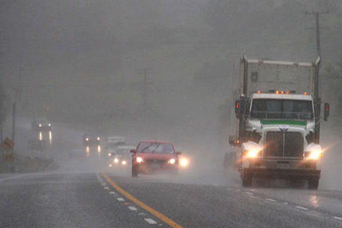
Heavy rain is expected for the central and upper North Island and north to northwest gales for Wellington and the Canterbury High Country.
"A front, preceded by humid northerlies, moves eastwards across the North Island during Sunday," says a MetService spokesperson.
"This front is expected to bring heavy rain to the central and upper North Island, with possible morning downpours over Auckland and Northland."
Heavy Rain Warnings and Watches are in force for many areas.
"In addition, north to northwest winds may approach severe gale in Wellington,including the Remutaka Hill Road, and in the Canterbury High Country."
People are advised to keep up to date with the latest forecasts, in case any changes are made or further areas are added.
Heavy rain warning:
Heavy rain may cause streams and rivers to rise rapidly. Surface flooding and slips are also possible and driving conditions may be hazardous.
Area: Northland
Valid: 12 hours from 2:00 am to 2:00 pm Sunday
Forecast: Expect 60 to 90 mm of rain. Peak rates of 25 to 40 mm/h in localised downpours during the morning, and possibly more.
Area: Auckland, including Great Barrier Island
Valid: 11 hours from 4:00 am to 3:00 pm Sunday
Forecast: Expect 60 to 90 mm of rain. Peak rates of 25 to 40 mm/h in localised downpours during the morning, and possibly more. Change note: Upgraded to an Orange Warning
Area: Bay of Plenty west of Opotiki
Valid: 27 hours from 11:00 am Sunday to 2:00 pm Monday
Forecast: Expect 110 to 130 mm of rain. Peak rates of 15 to 25 mm/h Sunday afternoon.
Note, rain may ease for a time Sunday evening.
Area: Bay of Plenty from Opotiki eastwards
Valid: 31 hours from 2:00 pm Sunday to 9:00 pm Monday
Forecast: Expect 150 to 200 mm of rain in the ranges, and 120 to 150 mm of rain elsewhere. Peak rates of 15 to 25 mm/h.
Area: Mount Taranaki
Valid: 12 hours from 8:00 pm Saturday to 8:00 am Sunday
Forecast: Expect 90 to 140 mm of rain to accumulate. Peak intensities of 20 to 25 mm/h.
Area: The Tararua Range
Valid: 11 hours from 10:00 pm Saturday to 9:00 am Sunday
Forecast: Expect 70 to 90 mm of rain to accumulate. Peak rates of 10 to 20 mm/h.
Heavy Rain Watch
Area: Coromandel Peninsula
Valid: 9 hours from 9:00 am to 6:00 pm Sunday
Forecast: Periods of heavy rain, with localised downpours possible. Rainfall amounts may approach warning criteria.
Area: Waikato and Taupo
Valid: 12 hours from 4:00 am to 4:00 pm Sunday
Forecast: Periods of heavy rain, with localised downpours possible. Rainfall amounts may exceed warning criteria in some areas.
Area: The central North Island hill country from Waitomo and North Taranaki to Tongariro National Park
Valid: 17 hours from 9:00 pm Saturday to 2:00 pm Sunday
Forecast: A period of heavy rain. Rainfall accumulations may approach warning amounts.

0 comments
Leave a Comment
You must be logged in to make a comment.