
Timing is everything - so having a powerful high pressure zone arrive just at the beginning of a long weekend may make a lot of New Zealanders happy, says WeatherWatch.co.nz.
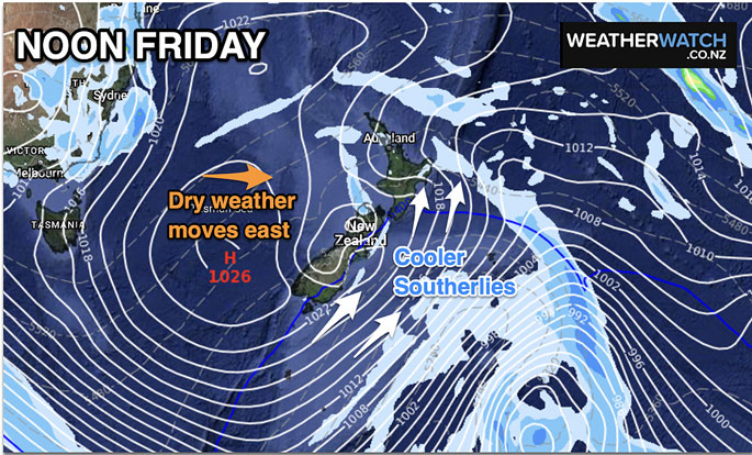
While the high pressure zone will encourage a colder end to the working week over the South Island and southern and eastern parts of the North Island, it will then cross the country over the three day weekend bringing mostly dry weather (especially for the North Island and upper South Island), says a spokesperson for the weather organisation.
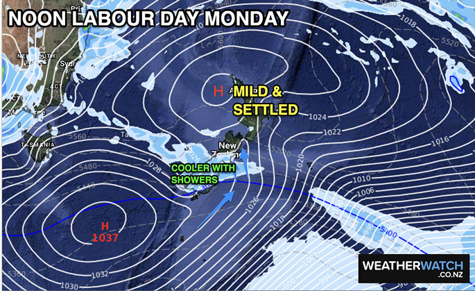
"By Sunday, the high will encourage milder airflows back over the South Island with highs back into the 20s.
"But by Monday a cooler, showery, airflow will arrive in parts of the South Island while the North Island remains underneath high pressure, so more likely to be settled and dry the further north you are.
"The high pressure zone will also limit the showers and snow flurries in the coming 48 hours - with a mainly dry set up. Most snow flurries will be in the mountains and tops of the South Island ranges and rain showers look brief with fairly low accumulation overall."
Long range and the next 7 days ahead look drier than average in the NZ area for this time of year.
WeatherWatch.co.nz says New Zealand may not have any further widespread nationwide rain events for the remainder of October, with more high pressure dominating.
"This is something we forecast in our October ClimateWatch update almost three weeks ago. Only Fiordland and Westland look to have heavier rain this month."
For hyper-local rainfall totals and graphs, please drill down deeper at RuralWeather.co.nz.


0 comments
Leave a Comment
You must be logged in to make a comment.