


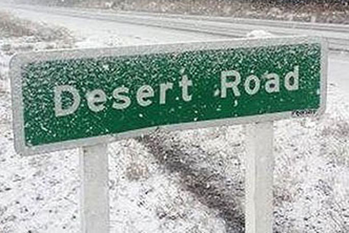
A snowfall warning is in place for the Desert Road as an icy blast moves up the country.
"An intense cold outbreak spreads northwards over the country today and on Thursday, bringing unseasonably low snow to the South Island and the lower North Island," says a statement from the MetService.
"South to southwest gales are also possible, especially in the east from Invercargill to Wellington. Snow is likely to affect many parts of the South Island and lower North Island.
"Heavy snow watches remain in force for many areas and warnings have been issued for the far south of the South Island and Banks Peninsula.
"Note that significant disruptive snow is also likely to affect many other areas.
"People are advised to proceed with caution and keep up to date with the latest MetService forecasts and advice from the NZTA. This event will bring significant impacts to transport, livestock and crops.
"People are advised to stay up to date with the latest forecasts in case further watches or warnings are added."
Road Snowfall Warning
Area: Napier-Taupo Road (SH5)
Period: 5hrs from 2am - 7am Thu, 6 Oct
Forecast: Snow showers are expected to affect the road overnight Wednesday and early Thursday morning. 1 to 2 cm of snow may accumulate above about 300 metres.
Area: Desert Road (SH1)
Period: 13hrs from 9pm Wed, 5 Oct - 10am Thu, 6 Oct
Forecast: Snow showers are expected to affect the road this evening and overnight Wednesday. Expect 3 to 5 cm of snow to accumulate.
Area: Dunedin to Waitati Highway (SH1)
Period: 32hrs from 10am Wed, 5 Oct - 6pm Thu, 6 Oct
Forecast: Snow showers are likely to affect the road Wednesday and Thursday. Expect a total of 6 to 9 cm to accumulate today and a further 4 to 6 cm tomorrow.
Area: Remutaka Hill Road (SH2)
Period: 18hrs from 10pm Wed, 5 Oct - 4pm Thu, 6 Oct
Forecast: Snow showers are expected to affect the road from Wednesday evening through Thursday afternoon. A total of 4 to 6 cm could settle above about 400 metres and lesser amounts to lower levels. Note that snow will probably not settle on the road till after midnight Wednesday since it will take a while for the road surface to cool sufficiently.
Area: Lewis Pass (SH7)
Period: 12hrs from 10am - 10pm Wed, 5 Oct
Forecast: 1 to 2 cm of snow may accumulate this morning. A further 3 to 5 cm may accumulate in snow showers late afternoon and into this evening.
Area: Arthur's Pass (SH73)
Period: 3hrs from 3pm - 6pm Wed, 5 Oct
Forecast: Snow showers later this afternoon are expected to bring another 2 to 4 cm of snow in addition to snow which has already accumulated.
Area: Porters Pass (SH73)
Period: 12hrs from 10am - 10pm Wed, 5 Oct
Forecast: Snow showers today are expected to bring another 3 to 5 cm of snow in addition to snow which has already accumulated. The risk of snow is greatest this morning and from late afternoon. There could be a break early afternoon when little if any snow accumulates.
Area: Haast Pass (SH6)
Period: 7hrs from 10am - 5pm Wed, 5 Oct
Forecast: Snow showers may briefly affect the road this morning and afternoon. Expect 1 to 2 cm of snow.
Area: Lindis Pass (SH8)
Period: 26hrs from 10am Wed, 5 Oct - noon Thu, 6 Oct
Forecast: Snow flurries may affect the road at times today and tomorrow morning. In addition to snow that has already accumulated, expect a further 1 to 2 cm today and another 1 cm or so tomorrow.
Area: Crown Range Road
Period: 35hrs from 10am Wed, 5 Oct - 9pm Thu, 6 Oct
Forecast: Snow flurries are expected to affect the road. In addition to snow that has already accumulated, expect a further 1 to 2 cm today and another 1 cm or so tomorrow.
Area: Milford Road (SH94)
Period: 35hrs from 10am Wed, 5 Oct - 9pm Thu, 6 Oct
Forecast: Snow showers are expected to affect the road today. Expect a further 3 to 5 cm in addition to the snow that has already accumulated. Some snow flurries may affect the road tomorrow and 1 or 2 cm more may accumulate south of about Lake Gunn then.

0 comments
Leave a Comment
You must be logged in to make a comment.