Significant heavy rain and severe gale northwesterlies are being forecast for parts of southern and central New Zealand.
The MetService has issued severe weather watches and warning for different parts of the country.
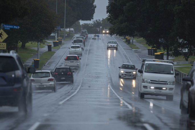
A severe weather watch is in force for the Bay of Plenty.
"An active front over Westland is expected to move over the northwest of the South Island during today, and across the North Island during Wednesday," says a spokesperson for the weather organisation.
"Additionally, a low develops north of Northland during today and should move southeast over eastern areas of the upper North Island early Wednesday morning.
"During Wednesday the front and low connect east of New Zealand with a larger and deeper low developing just east of central New Zealand.
"The front is expected to bring more heavy rain to the South Island today, and severe gale northwest winds across central New Zealand.
"The low from the north could bring a period of heavy rain to some eastern areas of the upper North Island. Southerly winds could reach severe gale about eastern areas of central New Zealand late Wednesday and during Thursday as the large low deepens.
"This continues to be a significant severe weather event. People are advised to keep up to date with the latest forecasts in case any changes are made, and more areas are added."
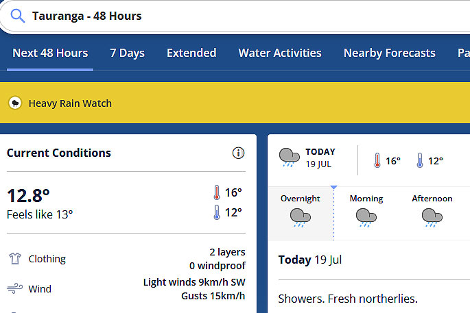 Image: MetService.
HEAVY RAIN WATCH
Area: Northland
Valid: 12 hours from 3pm Tuesday to 3am Wednesday
Forecast: Periods rain with heavy falls and thunderstorms possible, amounts may approach warning criteria.
Area: Bay of Plenty from Rotorua eastwards
Valid: 12 hours from 2am to 2pm Wednesday
Forecast: A period of rain, with heavy falls possible. Rainfall amounts may approach warning criteria.
Area: Taranaki, about and north of the Mountain
Valid: 15 hours from 3pm Tuesday to 6am Wednesday
Forecast: Periods of heavy rain and possible thunderstorms. Rainfall amounts may approach warning criteria, especially about the mountain.
Area: The Richmond and Bryant Ranges
Valid: 10 hours from 9am to 7pm Tuesday
Forecast: Periods of rain heavy at times. Rainfall amounts may approach warning criteria.
Area: Buller south of Little Wanganui
Valid: 8 hours from 8am to 4pm Tuesday
Forecast: Periods of heavy rain. Rainfall amounts may approach warning criteria, especially about the ranges.
Area: North Otago and the Canterbury Plains south of the Rakaia River
Valid: 7 hours from 9am to 4pm Tuesday
Forecast: Periods of rain. Rainfall amounts may approach warning criteria.
STRONG WIND WATCH
Area: Canterbury Plains and eastern Marlborough
Valid: 18 hours from 2am to 8pm Thursday
Forecast: Southerly winds are expected to strengthen in the early hours of Thursday, and may approach severe gale at times during Thursday.

0 comments
Leave a Comment
You must be logged in to make a comment.