
A mature low pressure system to the west of the North Island drives a warm, moist airflow over the country for the next few days.
MetService is forecasting either rain or showers to northern parts of the North Island today and the west coast of the South Island tomorrow ahead of an active front on Thursday.
Heavy rain and northerly winds precedes the front, with Heavy Rain Watches and Warnings now in force for the South Island http://bit.ly/AllWarnings.
The active front currently lying to the south of New Zealand then moves north late Wednesday into Thursday bringing wet weather to most of the country with more severe weather possible as well.
"With changeable weather expected around the country those travelling during this first week of the school holidays should keep up to date with our forecasts," says MetService Meteorologist Kyle Lee.
"Although temperatures have been feeling cooler during the Easter Weekend, we are in store for a warmer week ahead.
"Warm air is being streamed onto New Zealand from the tropics, so from tonight temperatures, especially the overnight temperatures are expected to be well above average for this time of year.
"Some centres could see overnight temperatures as high as 10C above average with the upper North Island barely dropping below 17C at night until Friday. For those who put the winter weight duvet on the bed, it might be kicked off in the coming nights."
The cold front on Thursday brings change as it sweeps across New Zealand, on top of the rain expected with the front, there is distinct temperature drop behind it too.
The good news is that Anzac weekend looks to be mainly settled for most as the front moves offshore during Friday leaving New Zealand in the wake of a drier and cooler southwest flow.
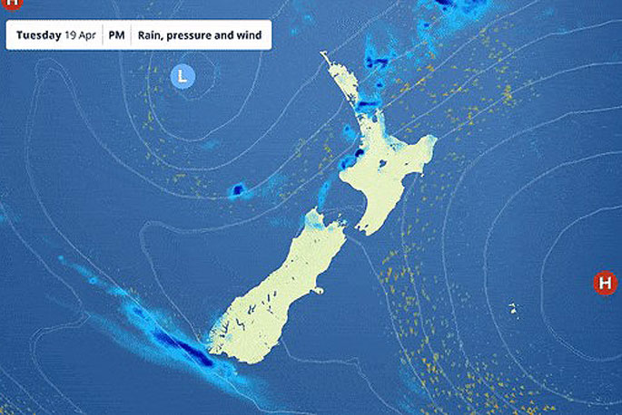 Image: MetService.

0 comments
Leave a Comment
You must be logged in to make a comment.