MetService has issued a severe weather warning for parts of central and northern New Zealand.
A slow-moving low pressure system is forecast to lie to the west of New Zealand this week, directing a moist north to northeast flow across the country.
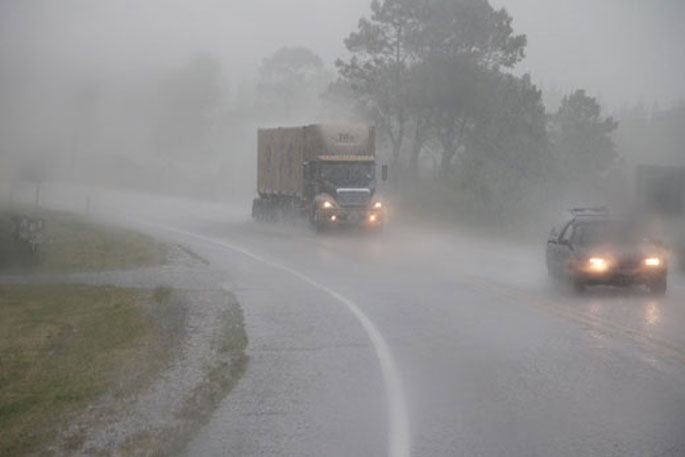
A front embedded in this flow is expected to move eastwards across northern and central New Zealand on Sunday and Monday, delivering a period of heavy rain to many places.
At this stage, the highest rainfall accumulation are expected in Northland,where an Orange Heavy Rain Warning is in force, while Heavy Rain Watches cover northern and eastern parts of Auckland including Great Barrier Island, the Coromandel Peninsula, western Bay of Plenty, northern Taranaki and northwest Tasman.
People are advised to keep up to date with the latest forecasts, as changes are likely to be made the coming days, or further areas are added.
Heavy rain may cause streams and rivers to rise rapidly. Surface flooding and slips are also possible and driving conditions may be hazardous.
The heavy rain watch for Northland is valid for 22 hours from 11am Sunday to 9am Monday, where 100 to 140 mm of rain is expected to accumulate, mainly in the north and east, though some localised areas may see larger accumulations. There may be peak rates of 15 to 25mm per hour, but localised downpours of 25 to 40mm per hour are likely in thunderstorms.
Heavy Rain Watch has been issued for the following regions:
Area: Auckland including Great Barrier Island
Period: 10hrs from 6am - 4pm Mon, 21 Mar
Forecast: Periods of heavy rain, with thunderstorms and localised downpours possible. Rainfall amounts may reach warning criteria in localised places, especially north of the Harbour Bridge.
Area: Coromandel Peninsula
Period: 10hrs from 10am - 8pm Mon, 21 Mar
Forecast: Periods of heavy rain, with thunderstorms and localised downpours possible. Rainfall amounts may reach warning criteria in localised places.
Area: Bay Of Plenty west of Opotiki
Period: 16hrs from 11am Mon, 21 Mar - 3am Tue, 22 Mar
Forecast: Periods of heavy rain and possible thunderstorms. Rainfall amounts may approach warning criteria. Please note, further heavy rain is possible on Tuesday, and this Watch may be extended closer to the time.
Area: Taranaki, about and north of the Mountain
Period: 12hrs from 5am - 5pm Mon, 21 Mar
Forecast: Periods of heavy rain and possible thunderstorms. Rainfall amounts may approach warning criteria.
Area: Tasman west of Motueka
Period: 18hrs from 6am Mon, 21 Mar - midnight Mon, 21 Mar
Forecast: Periods of heavy rain. Rainfall amounts may approach warning criteria .

0 comments
Leave a Comment
You must be logged in to make a comment.