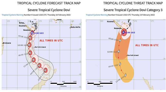
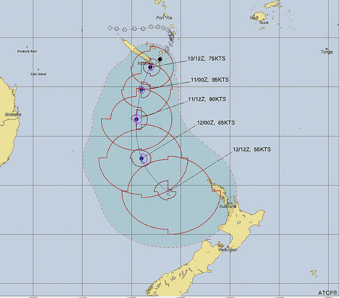
Cyclone Dovi has became a Severe Category 3 tropical cyclone as it tracks past the eastern side of New Caledonia, near Noumea, says WeatherWatch.co.nz
"The storm is expected to retain Cat 2 strength as it dive bombs into the NZ area this weekend from the north," says a spokesperson for the weather organisation.
"While it will have a lot of intense energy as it moves southwards over the Tasman Sea it is expected to unravel over NZ - but that means it will dump a lot of rain here and as it 'falls apart' it will also bring areas of damaging gales into both main islands."
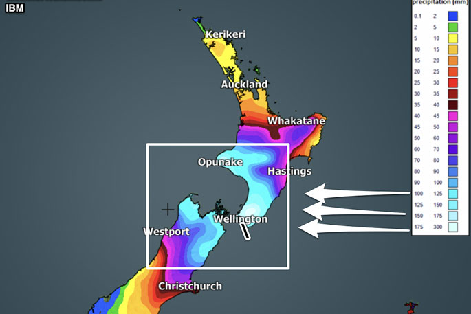
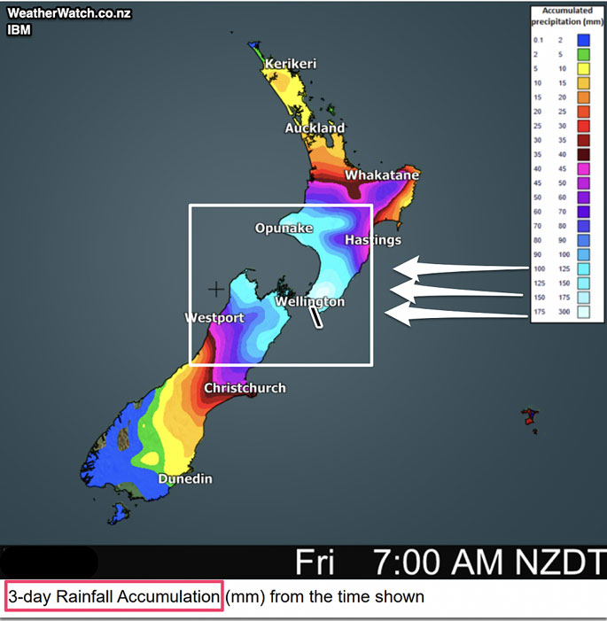
RAIN:
Heaviest rain looks likely to be through central NZ with 100 to 300mm possible (depending on how slow/fast Dovi moves through).
This is high enough to cause slips, flooding and road closures, says WeatherWatch.co.nz
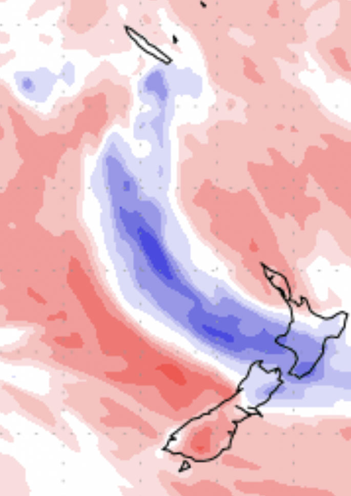
7 day rainfall map.
Blue = Wetter than average.
White = Normal rainfall for mid February
Red/pink = Drier than average
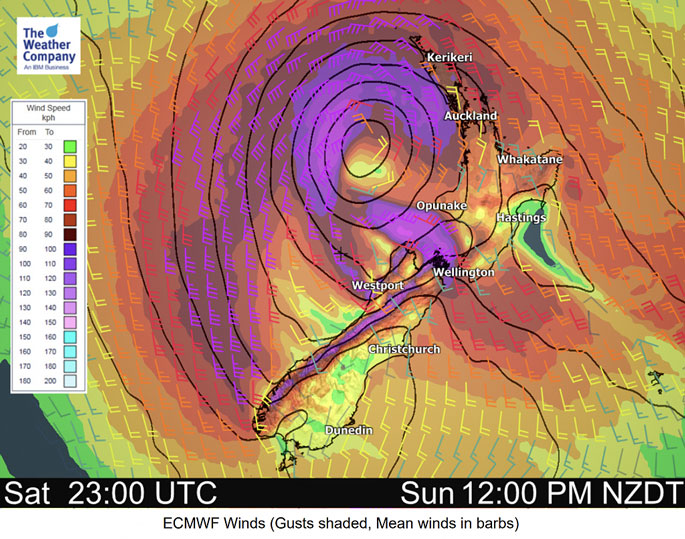
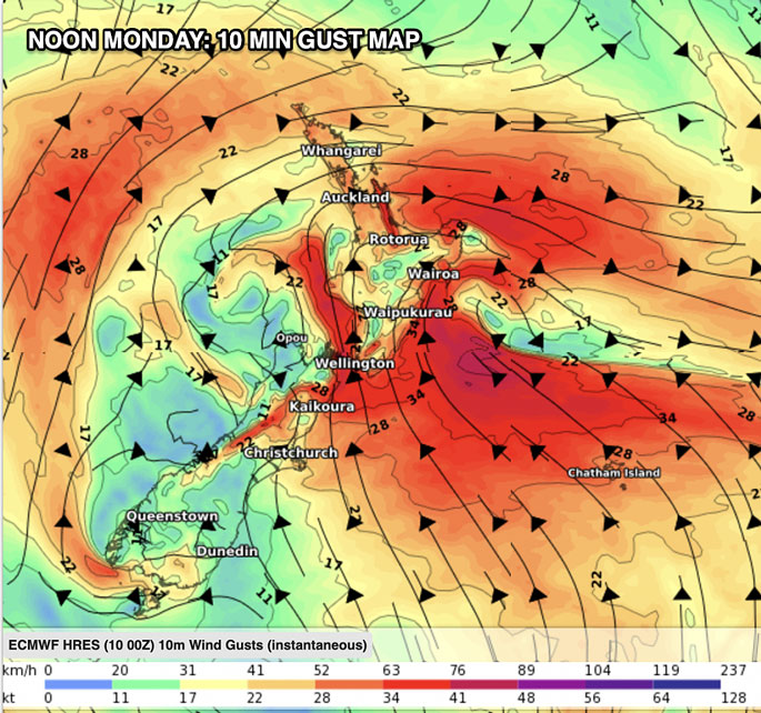
GALES:
"With the storm falling apart as it moves in - and will lose the tropical portion of Dovi's name, so it becomes Ex-Tropical Cyclone Dovi - it becomes a bit trickier to lock in which places will get the worst winds.
"Precise tracking of the centre of the storm is needed and, thankfully, reliable modelling is mostly in agreement - but more fine tuning will be needed over the coming day or two.
"Both islands are exposed to damaging winds for a time this weekend. Gusts may be anywhere from 100km/h to 150km/h and MetService will be issuing warnings for this."
You can find all MetService warnings and watches LIVE here. (slow loading time to open this page may be due to increased demand at MetService today).
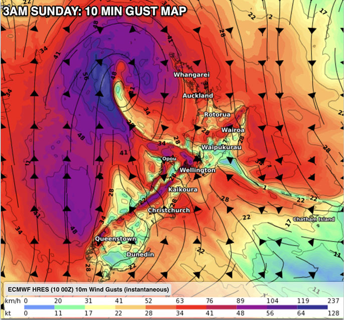
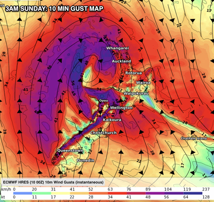
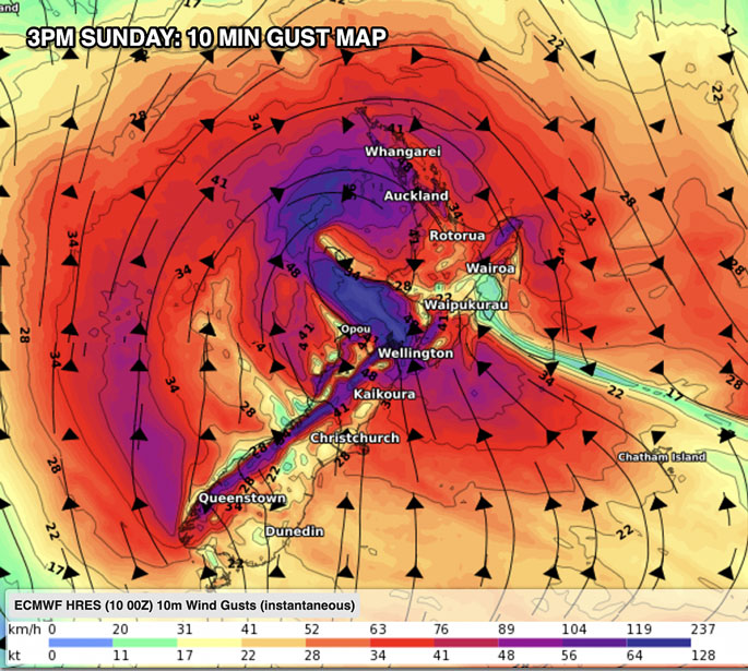
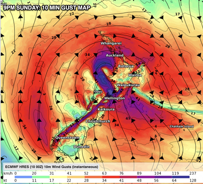

LANDFALL TIMING
WeatherWatch.co.nz says current estimates for landfall in NZ for the then ex-tropical cyclone look to be around 9pm Sunday to 3am Monday somewhere in the western North Island (give or take 6 hours at this early stage).
"Landfall is most likely between Waikato and Taranaki based on today's modelling.
'This may still change - and because the storm is unravelling here the 'landfall' portion becomes less important (as severe weather will occur in both islands due to the unusual shape the storm gets once it becomes ex-tropical - a process which sees the intense wind energy at the centre of the storm fan out further and break apart into sections."
Wind maps courtesy of our friends at Weatherzone.
Rainfall map courtesy of IBM / WeatherWatch.

0 comments
Leave a Comment
You must be logged in to make a comment.