As Cyclone Cody moves away, swell and wind are still expected to impact New Zealand.
It was a busy weekend for meteorologists as they kept a close eye on the erratic approach of Cyclone Cody, while the Tongan volcano - Hunga Tonga - Hunga Ha'apai - began showing renewed signs of unrest mid-last week, before dramatically erupting on Saturday.
The eruption spewed a massive cloud of ash into the atmosphere, generated tsunamis and produced a pressure wave that radiated around the globe.
'Saturday's eruption sent a shock wave speeding away from it which was not only recorded across MetService's extensive observation network here in New Zealand but was also recorded by pressure sensors as far away as Germany and the UK and is a testament to the enormity of the eruption,” says MetService Meteorologist Luis Fernandes.
As one of only nine Volcanic Ash Advisory Centres and an area of responsibility covering much of the south Pacific, including Tonga, MetService continues to closely monitor the movement and dispersion of the eruption's ash cloud in the region, issuing advisories to help aircraft avoid the affected areas.
Closer to home, Cyclone Cody moved further to the east of New Zealand on Monday.
While New Zealand has been spared the full brunt of this storm, it continues to have adverse effects for some areas.
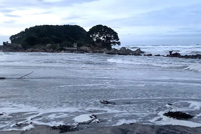
Strong winds around the cyclone have generated large swells that are still reaching parts of the north and east coasts of the North Island.
'Big swells have been affecting the northern coastline of the North Island since the start of the weekend with the wave buoy in Bay of Island measuring maximum wave heights of close to 7 metres which is really significant for this usually sheltered area.”
Fernandes says while the tsunamis from the Tongan eruption were also measured in Aotearoa, these consistent big swells are directly attributed to Cyclone Cody.
The large swells spread down the east coast on Monday and could still produce dangerous rips for the inshore areas of Gisborne and Hawke's Bay today.
The remains of Cody are expected to move well away to the southeast and a more typical weather pattern returns to the country.
A cold front will sweep up the South Island, bringing a noticeable jolt to temperatures mid-week, as well as a bout of wet weather.
The weakening front will pass over the North Island on Thursday with a dip in temperatures and some rain but by the time the front reaches Auckland and Northland in the afternoon, it will likely only result in a few showers for those areas where is has been consistently hot and dry for several weeks.
By the end of this week, high pressure is expected, and resultant settled weather will dominate over New Zealand.

0 comments
Leave a Comment
You must be logged in to make a comment.