
New Zealand is in for a warm and mostly settled week, as a ridge of high pressure lingers over the country.
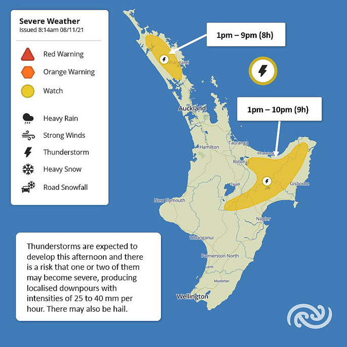
However, some areas are at risk of downpours and MetService has issued Severe Thunderstorm Watches.
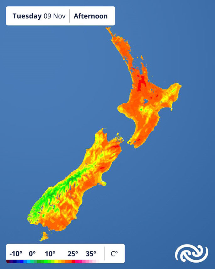
Most places have forecast maximum temperatures in the low to mid-twenties, with Alexandra set to reach 26C today (Monday), followed by Taumarunui and Masterton tomorrow.
With higher temperatures comes an increased risk of thunderstorms, says MetService meteorologist Alwyn Bakker.
'When the atmosphere is warmer and wetter at low levels than at higher levels, it's unstable. That means a small trigger, like converging winds, can make all that warm, moist air rise quickly and spark up a thunderstorm.”
MetService has issued two Severe Thunderstorm Watches for Monday afternoon and evening, covering inland Northland, and parts of Gisborne, Bay of Plenty, Hawke's Bay, and Taupo.
If a severe thunderstorm forms, localised downpours of 25-40 mm/hr are possible, as well as hail.
For an already-saturated Gisborne, localised downpours could have disproportionately large and quick impacts.
MetService reminds people in that area to follow the advice of the Regional Council and Civil Defence in the event of such downpours.
In contrast, continuing settled weather for the east coast of Te Waipounamu / South Island means parts of Canterbury and Otago are getting extremely dry. Other than the odd convective shower, that's set to continue for a few more days.
The mostly fine weather won't last, however.
A low pressure system is set to move across Te Waipounamu on Friday, bringing periods of rain to much of the country this weekend.
 Images: MetService.

0 comments
Leave a Comment
You must be logged in to make a comment.