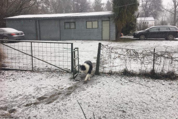
Heavy snow and severe gales are expected today for parts of central and northern New Zealand as a rapidly deepening low moves east across central New Zealand during today and early Monday.
This low is expected to bring heavy snow to low levels and severe gale southerlies across the central and northern districts of the country.
MetService has issued a road snowfall warning for Desert Road in the North Island. This is warning is valid from 10pm tonight until 11pm Monday.
'Snow, with some heavy falls from tonight until Monday morning,” says a MetService spokesperson. 'Snow showers are expected to continue through to Monday evening. Expect 15 to 25 cm of snow to accumulate on the [Desert] road.”
Further snow showers for Desert Road may continue through to Tuesday morning and this warning is likely to be extended, says MetServices.
The heaviest snow is expected in northern Canterbury and southern Marlborough above 200 metres, and central and southern parts of the North Island which is likely to disrupt travel, damage trees and powerlines, and cause stress to livestock.
A heavy snow warning has been issued for Taihape; the Tararua and Remutaka ranges including the Remutaka Hill Road; and Marlborough south of Seddon and Canterbury north of the Rakaia River, excluding Christchurch and Banks Peninsula.
The heavy snow warning for Taihape is valid from 11pm tonight to 9am Monday. Snow is expected to become heavy above about 500 metres where 15 to 30 cm of snow is forecast to accumulate. Snow showers down to 400 metres are likely to continue through to Monday evening affecting the Desert Road. Heavy snow may disrupt travel in affected areas and could damage trees and powerlines. Cold conditions may cause stress for livestock.
The heavy snow warning for The Tararua and Remutaka ranges, including the Remutaka Hill Road is valid from 8pm tonight to 7am Monday. Snow is possible down to 200 metres, and is expected to become heavy above about 400 metres, affecting the Remutaka Hill Road, where 15 to 30 cm of snow is forecast to accumulate. Snow showers down to 300 metres are likely to continue through to Monday evening affecting the Remutaka Hill Road.
The heavy snow warning for Marlborough south of Seddon and Canterbury north of the Rakaia River, excluding Christchurch and Banks Peninsula, is valid from 10am today to 9pm this evening. Snow is possible down to sea level, and is expected to become heavy inland above about 200 metres where 15 to 30 cm of snow is forecast to accumulate, or possibly more at higher levels. Snow showers are likely to sea level tonight and Monday morning, and these may affect Christchurch and Banks Peninsula.
People are advised to keep up to date with the latest forecasts in case any changes are made or further areas are added.
Heavy Snow Watch
A heavy snow watch has been issued for the inland ranges of Hawke's Bay and Gisborne south of the city, and for Marlborough about and north of Seddon, Nelson and Buller. Snow is possible down to 200 metres, and may become heavy above about 400 metres where accumulations may approach warning criteria.
A heavy snow watch has also been issued for Canterbury about and south of the Rakaia River. Snow is possible to near sea level, and may become heavy above about 300 metres where accumulations may approach warning criteria. Snow showers are possible to sea level tonight and Monday morning north of about Timaru.
Strong wind warning
A strong wind warning has been issued for southern and eastern Wairarapa including the coastal Tararua District. This is valid from 8pm Sunday to 1pm Monday. Strong wind gusts could damage trees, powerlines and unsecured structures. Driving may be hazardous, especially for high-sided vehicles and motorcycles. South gales are forecast to be severe in exposed coastal places, with gusts reaching 120 km per hour.
A strong wind warning has also been issued for Wellington, and coastal Marlborough north of Ward including the Sounds. This warning is valid from 4pm Sunday to 11am Monday. South to southeast gales are forecast to be severe in exposed places, with gusts reaching 120 km per hour.
A strong wind watch has been issued for the following areas:
Area: Northland about and south of Dargaville, Auckland, Great Barrier Island
Valid: 6 hours from 1:00 am to 7:00 am Monday
Forecast: South to southwest winds may approach severe gale in exposed places.
Area: Coastal parts of Hawke's Bay and Gisborne about and south of Tolaga Bay
Valid: 17 hours from 1:00 am to 6:00 pm Monday
Forecast: South to Southwest winds may approach severe gale in exposed places.
Area: Taranaki and coastal Whanganui
Valid: 10 hours from 9:00 pm Sunday to 7:00 am Monday
Forecast: South to southeast winds may approach severe gale in exposed places.
Area: Nelson, Buller, and Westland north of Bruce Bay
Valid: 14 hours from 4:00 pm Sunday to 6:00 am Monday
Forecast: Southeast winds may approach severe gale in exposed places at times.
Area: Hawkes Bay, Kapiti-Horowhenua and the remainder of Wairarapa including the Tararua District not under warning
Valid: 17 hours from 8:00 pm Sunday to 1:00 pm Monday
Forecast: South to southeast winds may approach severe gale in exposed places.
Area: Kaikoura Coast
Valid: 15 hours from 6:00 pm Sunday to 9:00 am Monday
Forecast: Southerly winds may approach severe gale in exposed places.

0 comments
Leave a Comment
You must be logged in to make a comment.