PowerCo is using low flying helicopters in the Bay of Plenty to inspect and take photographs of power poles in rural areas.
A Te Puna resident has contacted SunLive to say a helicopter has been circling around Te Puna West over the estuary to Whakamarama for around 30 minutes.
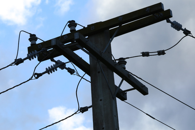
The helicopters are being used to collect data about the condition of the poles, assets and vegetation encroachments across PowerCo's network, according to the PowerCo website.
This survey uses pole top photography and LiDAR (light detection and ranging) technology to identify vegetation and any possible disruption issues, says the website.
From December 10 to December 24 and again from January 4 to January 31 the helicopters will be surveying rural Tauranga and the Bay of Plenty.
The helicopters will take high resolution photographs the power poles in the rural areas. The photos are then reviewed to assess the quality of the poles, crossarms and wires across the network, says the website.
"No photos will be taken of people or private land, just Powerco network assets.
'The technology enables Powerco to create a 3D digital twin of the network that can be used to assess the current state of the network and make upgrades as needed.
'As per Civil Aviation Authority requirements, the helicopters will only be flying in open air space, in urban areas this means above 1000 feet and in rural areas above 500 feet.”
For more information visit the PowerCo website.

0 comments
Leave a Comment
You must be logged in to make a comment.