Sodden centres around the North Island can breathe a sigh of relief as MetService forecasts the return of westerlies.
Strong southwesterlies, showers, and some southern snow shift the weather focus to the west this week, giving the east and far north a chance to dry out.
Its not looking too flash in the Bay of Plenty though, with a forecast of rain and possibly thunderstorms this afternoon.
The MetService says northerlies will change to westerly in the evening.
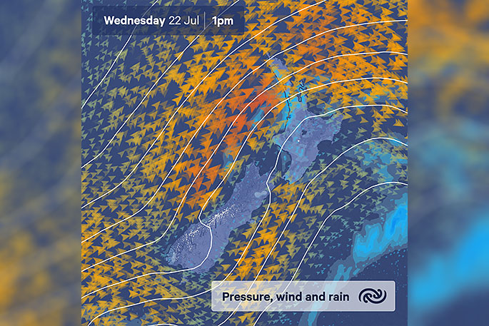
Meteorologist Tahlia Crabtree says on Wednesday a showery, southwest flow sets up for the remainder of the working week.
"Strong southwesterlies are expected, possibly reaching gale in exposed western regions including Auckland. Keep an eye on MetService's Severe Weather Warnings and Watches in the coming days.
Southwesterlies will bring a noticeable cold snap to northern regions, where relatively tropical teen temperatures have recently reigned. Meanwhile, Southland and Otago will trade in frosts and fog for an equally chilly dusting of snow.
Looking ahead, the outlook presents a bright weekend.
Tahlia says most weather will ease as a ridge pushes onto the country later this week.
"Just in time to hit the slopes.”

0 comments
Leave a Comment
You must be logged in to make a comment.