Autumn and winter so far have been fairly mild, but more typical wintry weather kicks in this weekend.
At the end of this week, a weak cold front will spread northwards up New Zealand, followed by a colder southerly flow - which is then immediately 'locked in' at night by more calming high pressure.
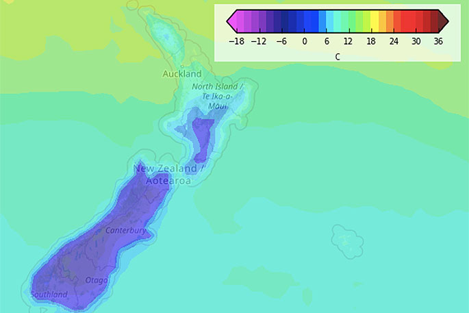
WeatherWatch.co.nz says this weekend high is connected to the 'enormous' high exiting Aussie right now and by this weekend will merge over New Zealand as one powerful high with air pressure close to 1040hPa.
"The high pressure system will keep the cold air stuck through inland valleys and see perhaps some of our biggest frosts so far this year. But who is affected will be limited with northern NZ cloudier, windier and milder.
"For the most part the South Island will be smack bang under the centre of this weekend high - so the cold southerly change at the end of this week will be locked in, seeing overnight lows plummet to possibly -5C through well inland areas like Tekapo."
Queenstown, Alexandra and Cromwell have overnight lows currently forecast between -1 and -3C this weekend, but some locations within, or near, these areas may dip to -5C creating heavy frosts.
"The coastal main centres of the South Island aren't looking so cold with wind and cloud cover keeping frosts limited - or mostly further inland."
To make sense of temperatures, wind chills and NZ's only public Frost Forecaster for your specific location, please visit www.RuralWeather.co.nz

0 comments
Leave a Comment
You must be logged in to make a comment.