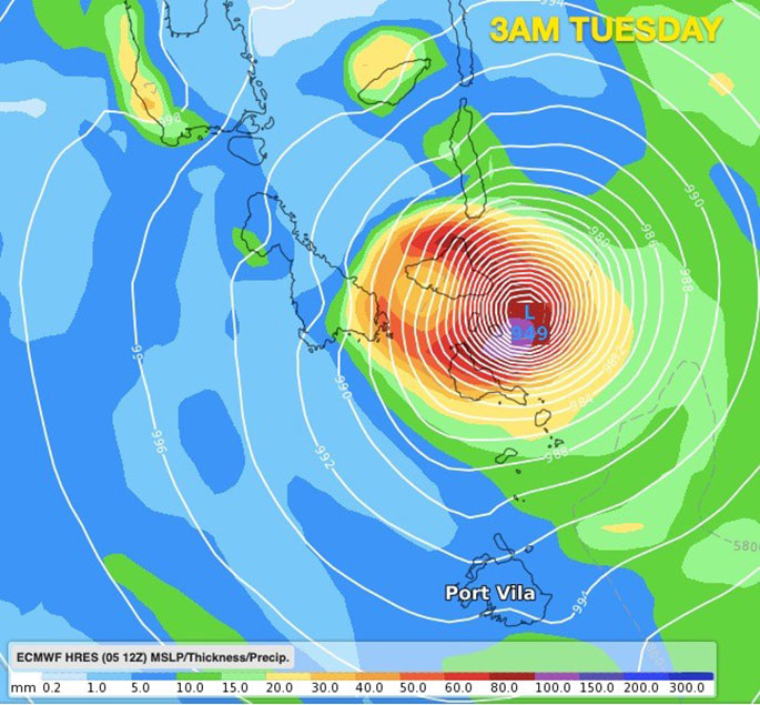
A worst case scenario is unfolding for Vanuatu today with Cyclone Harold reaching Cat 5 overnight, the highest level on the cyclone scale.
The violent and historical storm is now directly approaching Vanuatu.
It currently has sustained winds of 220 kmh (120 kt) with GUSTS to 270 kmh (145 kt).
Harold is slowly crawling towards Vanuatu in an easterly direction, moving at just 2 kmh (human walking speed is about 8 kmh).
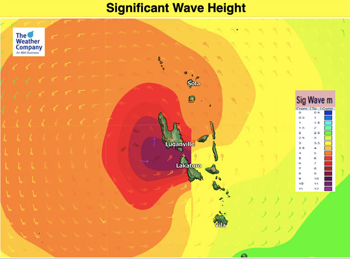
According to the US Joint Typhoon Warning Center (JTWC) satellite imagery shows the centre of Harold has a wobbly, but tightly packed eye. It is generating waves of 11 metres (36 feet).
'For those in Vanuatu it doesn't get much worse than this, a Category 5 tropical cyclone forecast to make direct landfall in a South Pacific nation,” says WeatherWatch.co.nz head forecaster Philip Duncan.
'There has been a decent build up to this storm with plenty of coverage but with the COVID-19 situation as well as a major Cat 5 cyclone makes this a much more complicated situation."
Philip says Harold is slow moving over very warm waters but one positive is that on Tuesday it pulls away from Vanuatu quite quickly.
Fiji has a close call and some islands south of the main island will be exposed.
Nadi remains outside most of the severe portion of weather on Wednesday but those in Fiji should closely monitor.
There is no direct threat for either New Caledonia or New Zealand.
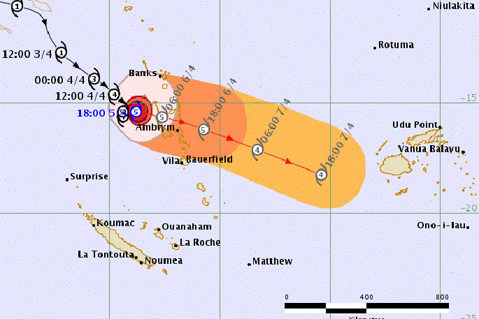
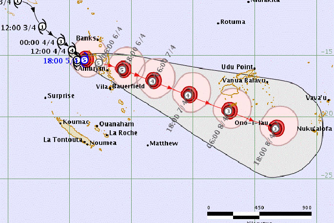
Above and below: LIVE TRACKING MAPS (auto updated via Fiji Met)
#BREAKING: ‘It doesn't get much worse than this' – Category 5 #CycloneHAROLD aiming for #Vanuatu today (+10 Maps) https://t.co/OGwbvV50u7 via @weatherwatchnz #cyclone #Harold #PortVila
— WeatherWatch.co.nz (@WeatherWatchNZ) April 5, 2020

0 comments
Leave a Comment
You must be logged in to make a comment.