Weatherwatch advises that Cyclone Tino which is heading towards Tonga today will churn up some New Zealand beaches early this week.
'Tropical Cyclone Tino is now a 'Severe' Category 3 storm as it moves away from Fiji and directly towards Tonga today,” says a WeatherWatch spokesperson. 'It will be north east of New Zealand by Monday as an ex-cyclone.”
There is currently no direct threat to New Zealand but WeatherWatch.co.nz says offshore storms will make some eastern beaches more dangerous in the North Island, especially around Monday and Tuesday and it's important to highlight the increased risk at some of the beaches as the weather above may be sunny and pleasant.
Overnight last night Cyclone Tino's centre skirted just east around Vanua Levu, mostly staying out at sea which helped it increase in power above initial forecasts to a ‘Severe' Category 3 Tropical Cyclone.
Weather conditions are improving in Fiji this morning with Tino short lived as it quickly tracks south towards Tonga.
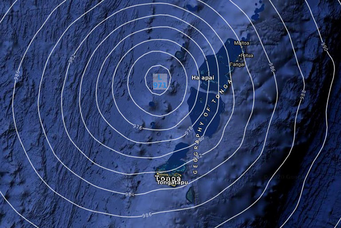
Saturday 3pm
'Tonga will be most affected between 3pm Saturday and 3am Sunday local time, likely peaking early this evening. This is not good news for Tonga with a direct or near hit likely this evening,” says a Weatherwatch spokesperson.
The centre of the storm will either cross directly over the island nation - or very nearby - later today.
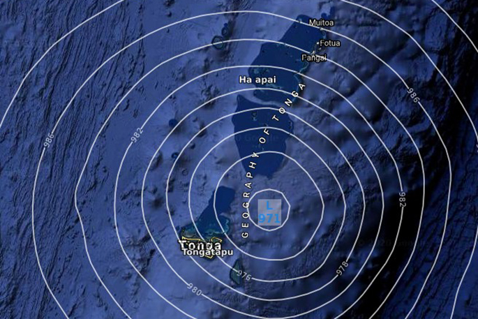
Saturday 6pm
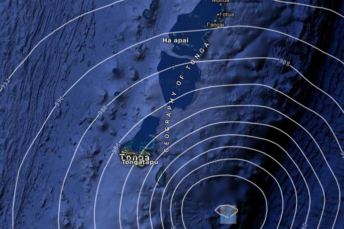
Saturday 9pm
'Torrential rain, severe coastal flooding, damaging winds which can destroy weak buildings entirely plus dangerous seas and storm surge can all be expected across Saturday and tonight. This storm has now increased in strength to the point that all people in Tonga must be prepared immediately for damage.
'The positive news is that it will be gone and clearing by Sunday morning. Perhaps a bit windy still but easing.”
Tino will become an ex-tropical cyclone this weekend as it moves far enough south from warm waters impacting our eastern coast beaches from Sunday afternoon through to Wednesday.
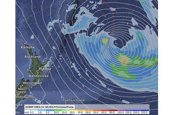
Noon on Monday
WeatherWatch.co.nz expects the remnants of Tino to really grow and intensify well to NZ's east into a much larger extra tropical low.
'This storm is a long way offshore and shouldn't affect NZ's weather at this stage - but the big size and close nature means it's worthy of WeatherWatch.co.nz issuing alerts for eastern beaches of the North Island with Monday and especially Tuesday the highest risk for more dangerous conditions in the water,” says a WeatherWatch spokesperson.
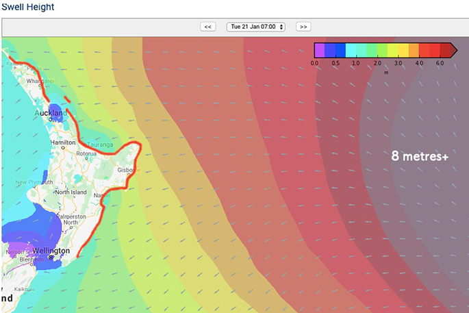
'Swells over four metres may be generated around some parts.
'Weather on land will likely be hot, sunny and settled in many places, masking the offshore dangers bringing random large waves and stronger than normal rips and currents.
'On Tuesday if the storm stays as far east as the swell map shows then NZ beaches will be brushed by larger waves and stronger rips for a few days. If it moves closer beach erosion can be expected. If it moves further out to the east it will minimise swells and wave heights in the North Island's eastern beaches. Either way, Monday and Tuesday appear to pose higher risk of eastern beaches being more dangerous.”

0 comments
Leave a Comment
You must be logged in to make a comment.