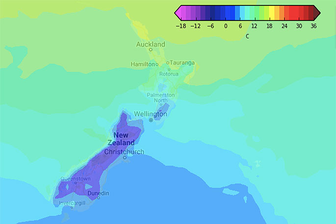
Sunday is a great example of spring - it will be cold in the South Island and lower North Island while a low with mild nor'westers affects the upper North Island.
The eastern South Island has a cold Sunday coming with single digit highs, some barely breaking past 5 to 7 degrees at the warmest point of the day.
'It's a bit of a strange set up thanks to high pressure to the south dredging up a cold southerly but at the same it will also be moving into the South Island easing those winds and drying out the skies,” says WeatherWatch.co.nz
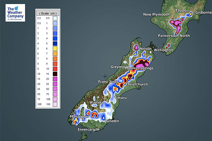
'Still, further north where that colder air combines with the rain clouds in the north we'll see snow showers forming around North Canterbury hills and ranges with a few light but lower level snow flurries possible at night briefly.”
 Sunday.
The North Island will be colder in the lower half and milder in the northern half with the top of the country in the mid to late teens.
'There will be mix of rain, showers, drizzle and dry spells over the island. As we head into Sunday and Monday that colder southerly very slowly moves up the North Island.
'One interesting note is that as this cold southerly collides with the mild rain over the North Island it will turn that rain to snow over the Central Plateau.
'Heavy snow is expected around the Central North Island mountains and ranges and some snow might impact the Desert Road and plateau from Sunday to Tuesday.”

0 comments
Leave a Comment
You must be logged in to make a comment.