Heavy rain and northeasterly gales are forecast to lash the region this afternoon.
A complex low and associated fronts are expected to move onto the upper North Island today, then over the rest of the Island and the top of the South Island on Wednesday, says the MetService.
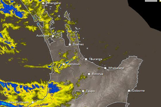
A heavy rain watch issued by the MetService on Monday has now been upgraded to a warning.
'These features should bring northeasterly gales and periods of heavy rain to northern parts of the North Island.
'A heavy rain warning is now in force for western Bay of Plenty and Gisborne north of Ruatoria, and a heavy rain watch is force for eastern Bay of Plenty, Coromandel Peninsula, Auckland and Northland.”
Meanwhile, a strong wind watch is still in force for Auckland.
'Also note, due to higher than normal tides over the next few days, there is a possibility of coastal inundation in areas exposed to strong northeast winds.
'People are advised to keep up to date with the latest forecasts in case any updates are made to the Watches or Warnings, or further areas are added.”
Area: Bay Of Plenty from Whakatane westwards, including Rotorua
Valid: 18 hours from 9pm Tuesday to 3pm Wednesday
Forecast: Periods of heavy rain. Expect 80 to 120 mm of rain to accumulate during this period. Peak rates of 10 to 20 mm/h, with heaviest falls expected overnight Tuesday and Wednesday morning, and thunderstorms possible. Please note, further heavy showers are expected during Thursday morning.
Changes: upgrade to warning

0 comments
Leave a Comment
You must be logged in to make a comment.