
WeatherWatch reports there is a very large low pressure system covering NZ with mild weather in the north and colder conditions in the south.
Some places in the south will actually warm up a little today while those further north staying warm, but colder air is coming in the days ahead for many places.
Windier weather is moving in for some places over the next few days too, as low pressure deepens south of New Zealand.
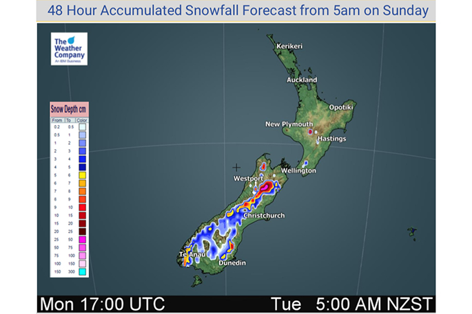
Snow flurries will affect inland parts of the South Island today and colder air flows will remain stuck around the lower South island until mid-week.
While a colder air flow is surging north this week the good news is that the most polar of it will be to the east. Still, wind chills will remain a bit tough for newborn livestock for the next few more days in some areas.
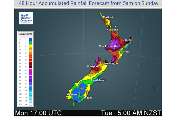
Isolated thunderstorms, squalls and hall are also moving in off the Tasman Sea ahead of the strong westerly to southwesterly flow moving in.
Here are WeatherWatch's updated rain and snow maps for the next 48 hours:

0 comments
Leave a Comment
You must be logged in to make a comment.