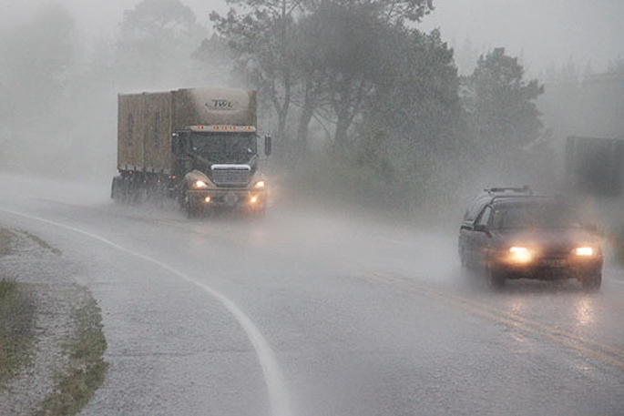
Heavy rain is forecast for the ranges of eastern Bay of Plenty and Gisborne, Taranaki and western Nelson.
An active front lying over central New Zealand should continue moving slowly eastwards across the North Island during Sunday and Monday before moving away to the east early Tuesday morning.
The front delivers a period of northerly rain across the North Island, with the heaviest falls expected in Taranaki, the ranges of eastern Bay of Plenty and the Gisborne ranges.
In addition, an associated low should direct an east to southeast flow across the upper South Island, delivering a period of heavy rain to Nelson west of Motueka.
People are advised to keep up to date with the latest forecasts in case other areas are added to the warning.
Heavy rain may cause streams and rivers to rise rapidly. Surface flooding and slips are also possible and driving conditions may be hazardous.
Area: The ranges of eastern Bay of Plenty and the Gisborne ranges
Valid: 18 hours from 8:00am Monday to 2:00am Tuesday
Forecast: Heavy northerly rain. Expect 80 to 120mm of rain to accumulate during this time, especially about and east of the Waioeka Gorge. Peak intensities of 15 to 25mm/hr, possibly more, and thunderstorms possible.
Area: Taranaki, especially about the mountain
Valid: 18 hours from 9:00am Sunday to 3:00am Monday
Forecast: Expect 100 to 140mm of rain to accumulate about the mountain, and up to 80mm elsewhere, especially north of the mountain. Peak intensitites of 15 to 25mm/hr, possibly more, and thunderstorms possible.
Changes: Upgraded from Watch to Warning.
Area: Nelson west of Motueka
Valid: 14 hours from 9:00pm Sunday to 11:00am Monday
Forecast: Expect 70 to 100mm of rain to accumulate during this time. Peak intensities of 15 to 25mm/hr, possibly more, and thunderstorms possible.
Source: Meteorological Service of New Zealand

0 comments
Leave a Comment
You must be logged in to make a comment.