
UPDATED 7.55am: A thunderstorm watch initiially in place for the Bay of Plenty this morning, has now been lifted,
The watch was initially forecasting scattered thunderstorms orthern parts of the North Island early to mid-morning Thursday.
Upon reviewing the lastest weather maps, MetService says this is no longer the case.
The weather organistaion is still predictin rain for this morning, but say it should ease to showers in the afternoon.
EARLIER:
A severe thunderstorm watch is in place for many areas around the North Island, including the Bay of Plenty.
The MetService says scattered thunderstorms are expected about northern parts of the North Island early to mid-morning Thursday.
'There is a risk that some of these thunderstorms could become severe from North Taranaki up to Northland and across to Coromandel Peninsula and Western Bay of Plenty, producing localised very heavy rain or downpours of 20 to 35mm per hour and possibly a small coastal tornado,” says the weather organisation.
'Rainfall of this intensity can cause surface flooding and may also lead to slips and hazardous driving conditions. If any tornadoes occur, they will only affect very localised areas.”
There is already some surface flooding along Takitimu Drive, near the Waihi Road overbridge.
Motorists are advised to adjust their speed, as the roads could be slippery in wet conditions.
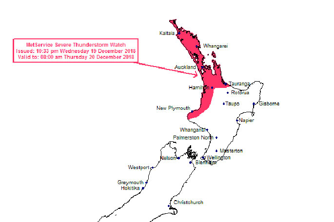
This watch affects people in the following weather forecast districts:
Northland
Auckland
Great Barrier Island
Coromandel Peninsula
Waikato
Waitomo
Bay of Plenty
Taranaki

0 comments
Leave a Comment
You must be logged in to make a comment.