An enormous high pressure donut is circling New Zealand.
It's a rare set up that sees a large circular area of high pressure over the New Zealand area, stretching up into the subtropics, down into and Southern Ocean, spread as far west as Aussie and as far east as the International Date Line.
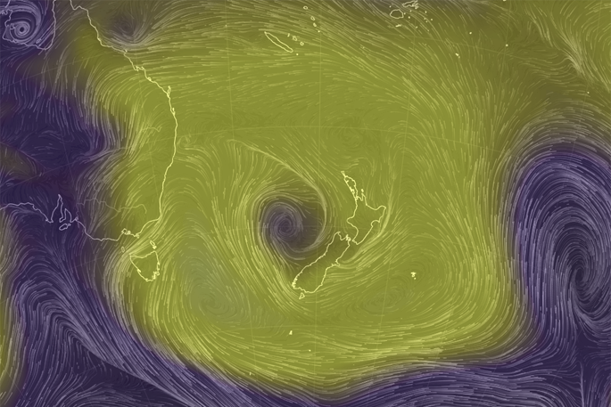
However, in the middle of this big bubble of high pressure lies a weak low - the hole in the donut.
On the air pressure map below, which shows winds and high/low pressure, the small area of low pressure can be clearly seen in the Tasman Sea in purple shading. (High pressure in yellow shading).
This means the high brings mainly light winds for most places but the low will help bring in some moisture - coupled with afternoon heating.
It's why New Zealand has several days ahead with inland downpours and isolated thunderstorms, despite the mainly dry mornings.
An usual set up which will be gone by the weekend as high pressure grows and 'fills in' this low, leaving behind increasingly dry weather and fewer downpours.
-WeatherWatch.co.nz/Philip Duncan.

0 comments
Leave a Comment
You must be logged in to make a comment.