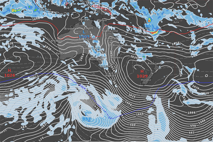
High pressure is about to lock itself in over New Zealand for most, if not all of next week and perhaps the following weekend too.
The up tick in higher air pressure is from a belt of anticyclones (also known as 'highs') which are tracking in a line around the planet and are especially strong around New Zealand soon. says WeatherWatch,co.nz
Next week the country will have high pressure centres both to the west and the east of our main islands and both highs will affect New Zealand bringing warmer and drier than average weather to many regions.
"But amongst this big dry we also have a risk of afternoon downpours and some may be quite intense with localised falls heavy enough to caused some flooding (either surface flooding, flash flooding or low-end-stream flooding).
"It's hit and miss but for the most part these downpours begin this weekend and become more intense next week...but most will be inland and in remote areas, national parks or ranges. There is a chance they could drift into populated areas but it's too early to lock in."
Most main centres look dry this weekend and next week and for the most part these highs will bring mostly settled and dry weather to New Zealand which will tip some regions further into the "drier than normal" category for this time of year.
"One positive is that the West Coast, hit by significant flooding and washouts yesterday, also has a drier than average week coming up."

0 comments
Leave a Comment
You must be logged in to make a comment.