A high pressure system, bringing largely settled weather to New Zealand this Labour Weekend, is set to persist over parts of the country into the week ahead.
'There's plenty of moisture trapped under the high and this will affect western parts of both islands on Labour Day. This means areas of cloud at first light, breaking up in the morning, then bubbling up and forming one or two showers inland during the afternoon and evening,” says Meteorologist Rob Kerr.
'We can expect a similar story for the North Island during Tuesday and Wednesday as well,” he added.
'However, a northwest flow builds over the South Island on Tuesday, bringing rain to western parts and warm winds to the east of the island right through Wednesday. A cold front then sweeps northwards over the South Island on Thursday bringing rain to most areas, before it weakens and stalls over Central New Zealand on Friday.”
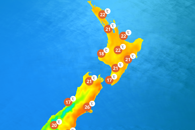
In fact, warmer than average temperatures are expected right across the country during the first part of this week, with the South Island likely to see the highest highs.
Temperatures are forecast to reach the mid to high 20's about eastern areas from Alexandra all the way to Blenheim, while only Masterton's mercury is expected to reach such heights in the north.
And remember, if you are spending longer outside in the sun during these warm spring days, it always pays to stay sun smart and ‘Slip Slap Slop and Wrap'.

0 comments
Leave a Comment
You must be logged in to make a comment.