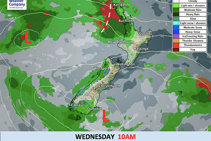
New Zealand remains under a deep low pressure system providing unstable conditions leading to isolated thunderstorms, heavy downpours and isolated tornados.
Localised heavy downpours, lightning and damaging gusts will all be possible in the North Island and the Tasman Sea side of the South Island today.
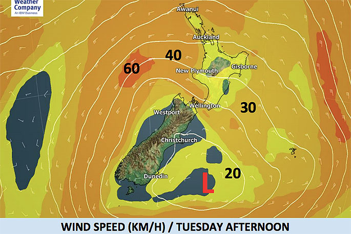
Generally speaking wind speeds will reach 20-30km/h across the North Island and Cook Strait, but in isolated gusts associated with thunderstorms or large downpours winds may jump over gale force suddenly, says WeatherWatch.co.nz
With so much instability WeatherWatch.co.nz cannot rule out further (isolated) tornado risks for the upper North Island on Wednesday.
People are still cleaning up after a tornados tore through New Plymouth and Ohope last night.
'There's another surge of heavy downpours, hail and maybe thunder on Thursday too - this is when bulk of the low pressure finally shifts entirely over to the eastern side of NZ and encourages a colder southerly flow up the country.
'This process could bring another burst of downpours with possible hail and snow may even affect the Desert Road for a time on late Thursday or early Friday.
'Snow flurries are likely across the Southern Alps too and may affect Alpine Passes briefly.
'Here's the good news: A big high is rolling in this weekend and should bring mostly settled, sunny and calm weather to many regions from Sunday to the middle of next week.”

0 comments
Leave a Comment
You must be logged in to make a comment.