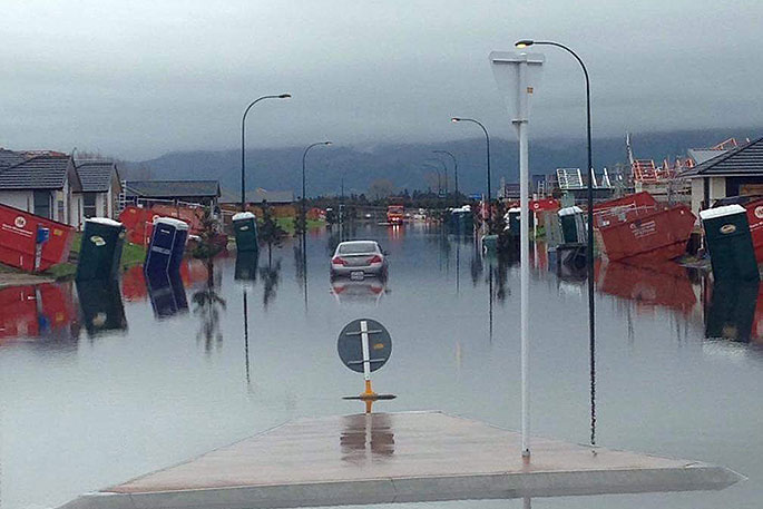
A low to the northeast of New Zealand has been sweeping bands of heavy rain and thunderstorms over parts of the North Island, causing flooding, slips and road closures.
As the low approaches the country during Monday, further periods of heavy rain with possible thunderstorms are expected for already sodden areas.
Heavy Rain Watches remain in place for Northland, Auckland, Coromandel Peninsula, Bay of Plenty and northern Gisborne, as well as the Kaikoura Coast and Ranges.
'Over the past two days, we have seen some massive rainfall totals in many northeastern parts of the country,” says MetService Meteorologist Claire Flynn.
'In the 48 hours to midday Monday, more 100mm of rainfall was recorded at many weather stations around Northland, Coromandel Peninsula, western Bay of Plenty including the Kaimai Range, and the ranges north of Gisborne.
"While the rain has eased temporarily for some of these places, they are not out of the woods yet as further bands of heavy rain are sweeping over the country on Monday and during Tuesday morning, and a Heavy Rain Watch remains in place.”
No sooner will this weather system have moved away from the country on Tuesday afternoon, then the next weather system approaching from the south will begin to affect the country.
A Severe Weather Watch is in force for severe southwesterly gales about the coast of Dunedin and Clutha from Tuesday evening.
A Heavy Snow Watch has also been issued.
'The next weather system is approaching from the south, and is expected to lower snow to low levels from Tuesday night and into Wednesday.
"Snow is forecast down to 200 metres in the far south on Tuesday night, with a Watch in place for heavy snow above altitudes of 400 metres about inland Southland, Otago and Fiordland.”
Road snowfall warnings have also been issued for Lindis Pass, the Crown Range Road, and Milford Road from late Tuesday afternoon into Wednesday morning.

0 comments
Leave a Comment
You must be logged in to make a comment.