The front that produced the lightning strike that hit a plane trying to land at Wellington Airport on Tuesday evening, has moved up the country bringing thunderstorms and hail to much of the North Island.
Around 5am Wednesday the front was to the east of Northland and over the East Cape area, and most of the risk of severe thunderstorms had passed, says MetService meteorologist Peter Little.
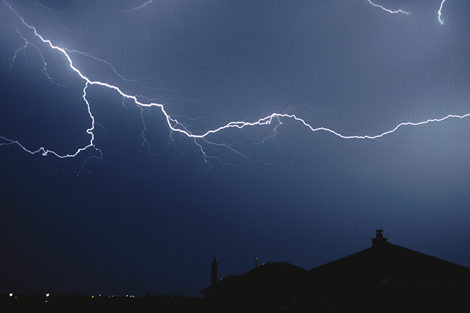
In the 24 hours to 5am there were about 9500 lightning strikes across the country, most in the west.
"Many places have had quite strong winds, but the strongest winds were around Wellington and other generally exposed sites," says Peter.
A gust at Mt Kaukau in Wellington was measured at 130kmh in the hour to 9pm, which coincided with the thunderstorm activity in the capital. Kelburn had a gust of 102kmh, while a gust of 92kmh was recorded at Hawera.
Nature has been putting on quite a show with around 9500 lightning strikes detected in the New Zealand region over the last 24 hours. The atmosphere remains unstable today, so there continues to be a thunderstorm risk https://t.co/BZWb7ZPiRd ^PL pic.twitter.com/71efPEUCEg
— MetService (@MetService) May 22, 2018
"In terms of rainfall, there's been very brief heavy rain in most places, but because the storm's moving quite quickly it didn't drop a large amount of rain. It wasn't sitting in one place for a long time."
He had seen pictures of hail up to about 20mm in diameter that fell in Wellington during the storm, which was quite large for the capital.
"It certainly was a decent hailstorm and very strong winds, pretty heavy rain as well."
The worst of the weather had passed but it would remain unsettled on Wednesday.
"The atmosphere remains quite unstable across much of the country. It's quite a showery day, particularly for western and southern places," says Peter.
"There will be further thunderstorms but we're not expecting the activity to be quite as widespread as it was last evening."
Overnight MetService issued road snowfall warnings for Lewis Pass, Arthur's Pass, the Crown Range Road, and Milford Road.
Some snow had fallen overnight in the lower South Island, including on the Crown Range Road, although by 5am the road looked to be reasonably clear on webcam, and stars were out, says Peter.
The Milford Road also had a bit more snow overnight.
Early on Wednesday, the NZ Transport Agency said State Highway 94 between Hollyford Valley Rd intersection and the Chasm Stream Bridge was closed because of snow, but was likely to reopen by 10am.
MetService has also warned that showers, some heavy with hail and snow, could fall to 300 metres in Otago and Southland on Wednesday.
It is expected to stay mostly dry in North Otago and the showers are forecast to retreat to the south coast by the evening.

0 comments
Leave a Comment
You must be logged in to make a comment.