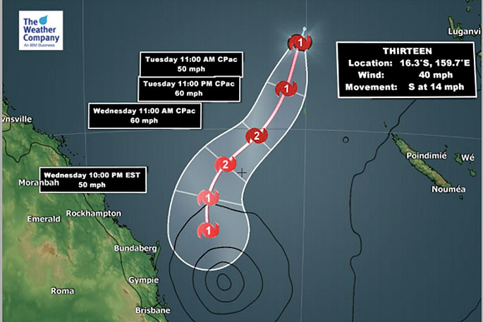
A small tropical cyclone has formed in the Coral Sea, according to the Joint Typhoon Warning Center.
"Australian forecasters will be responsible for naming it, which should happen today and if so it will be named Linda," says WeatherWatch.co.nz
"Australian forecasters are still only calling it a "tropical low" as of 10am NZDT."
Unlike the three recent cyclone threats to New Zealand this one is not expected to come to us as a storm - in fact the life of this cyclone may only be a day or two as it tracks into unfavourable conditions for cyclone formation, says the weather organisation.
"However the localised but intense tropical downpours are expected to drift towards the upper part of the North Island this Friday and perhaps return off and on a bit this weekend and early next week."
Main Features:
- A Tropical Low emerged from around Solomon Islands has been upgraded to a Tropical Cyclone in the Tasman sea by the JTWC.
- It will track southwestward and then southward and lie just off the coast from Brisbane around Wednesday night.
- Wind speeds near gale force are possible in coastal areas from Bundaberg to Brisbane and Lismore from Wednesday night to Thursday morning.
- There is the risk of locally heavy temporal rainfall along cloud bands of the cyclone across coastal cities including Gold Coast and Brisbane on Wednesday and Thursday. Rain accumulation is not likely to be heavy.
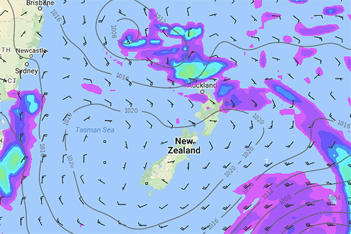
- The remnants of this short lived storm will drift towards New Zealand around Friday and the weekend in the form of isolated but heavy downpours, mostly lying north of the country but may brush the upper North Island.

0 comments
Leave a Comment
You must be logged in to make a comment.