West Coast authorities are already preparing for the ex-tropical cyclone Gita to hit, despite not being sure exactly what it could bring.
Mayors and council chairs in the region met on Sunday to discuss how to prepare for the storm, and would meet later again today to get an update from MetService.
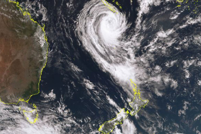
MetService has forecast the storm will hit central parts of New Zealand late tomorrow after causing havoc in the Pacific, flattening and flooding homes and knocking out power and communications in Tonga, Samoa and some Fiji islands.
There were a "few things" they could get underway already, but today would provide a better picture of how the storm was likely to hit, says West Coast Regional Council chief executive Mike Meehan.
"The key part of the modelling for us is what's going to be the impact on those coastal communities with potential storm surge, also mindful of the rain that could come with it ... then of course the wind is obviously of concern as well, and how all those things interact with each other."
TC #Gita will bring strong winds to the lower North Island and upper South Island on Tuesday and Tuesday night.
— NIWA Weather (@NiwaWeather) February 18, 2018
The highest gusts may exceed 110 km/h across Taranaki, Wellington, Tasman, Nelson, Marlborough, and northern Canterbury.
Secure any loose items in your yard! pic.twitter.com/b08YQjlKFf
Once a clearer picture is found decisions would be made around moving people, and whether sandbags were needed.
Authorities were conscious some communities had already been hit by cyclone Fehi, and some people just starting to rebuild might be hit again.
Nelson mayor Rachel Reese says the council would constantly be in touch with residents, and the best thing they could do was be prepared.
"They should have their emergency kits and their evac plans ready and we're really asking people to be neighbourly and look out for vulnerable people on your street, [and] make sure older people have got some support.
The storm has been predicted to hit Tuesday night or Wednesday morning.
MetService says on Sunday a heavy rain watch had been issued for the lower North Island from Horowhenua to Wellington, and including Wairarapa and the Tararua Range.
Heavy rain was likely to fall over the South Island from Westland and Canterbury north.
The storm was also likely to bring severe gales to those areas.
Cold air being dragged northwards could cause unseasonably low levels of snow in the Canterbury High Country on Tuesday.
![]()

0 comments
Leave a Comment
You must be logged in to make a comment.